Disclosure : This site contains affiliate links to products. We may receive a commission for purchases made through these links.
Vietnam, Laos & Cambodia ITMB
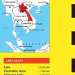
Vietnam, Cambodia and Laos at 1:1,250,000 on an indexed, double-sided overview map at 1:1,250,000 from ITMB. Altitude colouring shows the topography of the region, with numerous spot heights in mountainous areas. Swaps and land subject to inundation are also marked. National parks and other protected areas are highlighted.The map divides the region north/south, with a generous overlap between the sides, so that the whole of Laos is on one side, the whole of Cambodia on the reverse and only Vietnam divided between the two sides. The map shows the region’s road and rail networks, with driving distances on main routes and locations of border crossings. Within Vietnam various routes of the Ho Chi Minh Trail are highlighted. The map indicates numerous places of interest, both historic sites and natural curiosities, with some in Vietnam annotated with brief descriptions. Latitude and longitude lines are drawn at intervals of 1ยฐ. Each side of the map is indexed separately.

Related Products:
 Thailand, Vietnam, Laos & Cambodia ITMB Travel Atlas
 Indochina: Vietnam – Laos – Cambodia Reise Know-How
 Vietnam – Laos – Cambodia Nelles
 Vietnam, Cambodia & Laos Insight Travel Map
 Vietnam – Laos – Cambodia Wall Map
 Vietnam – Laos – Cambodia Gizi Map
 Vietnam, Laos & Cambodia Flexi Map
 Vietnam – Laos – Cambodia F&B
 Vietnam, Cambodia & Laos
 A Dragon Apparent – Travels in Cambodia, Laos and Vietnam
 Vietnam – Laos – Cambodia Michelin
 Thailand – Vietnam – Myanmar / Burma – Cambodia – Laos Marco Polo Map
 The Complete Asian Cookbook Series: Thailand, Vietnam, Cambodia, Laos & Burma
 Vietnam ITMB
 Lonely Planet Vietnam, Cambodia, Laos & Northern Thailand
 Hanoi – Vietnam North ITMB
 Insight Guides Laos & Cambodia
 DK Eyewitness Travel Guide Cambodia and Laos
 Laos Periplus Travel Map
 Hue – Da Nang & Vietnam Centra ITMB
 Ho Chi Minh City / Saigon & Vietnam South ITMB
 Short History of Laos – The Land Inbetween
 Cambodia Periplus Travel Map
 Cambodia – Angkor Nelles
 Vietnam South Reise Know-How
 Laos & The Mekong River from Source to Sea Odyssey Map
 Vietnam: ITMB Regional Maps
 Southern Vietnam – Mekong Delta ITMB
 Laos Reise Know-How
 From China to Vietnam: A Food Journey Along the Mekong River
 San Diego & USA South West Border ITMB
 Vietnam North Reise Know-How
 Africa North ITMB
 Fodor`s Essential Thailand: with Myanmar (Burma), Cambodia & Laos
 Patagonia & Tierra del Fuego ITMB
 Cambodia – the Khmer Legacy Odyssey Illustrated Map
 Africa East & Central ITMB
 Laos ITMB
 Rome & Southern Italy ITMB