Disclosure : This site contains affiliate links to products. We may receive a commission for purchases made through these links.
Victoria High Country

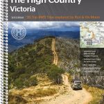
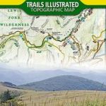
Victoria’s High Country, the mountains of the Great Dividing Range including the Alpine National Park, on a contoured and GPS compatible map at 1:200,000 from Hema printed on light, waterproof and tear-resistant synthetic paper. The map is double-sided with a good overlap between the sides; coverage in the west starts at Mansfield, north-east of Melbourne, and extends across the border of New South Wales to include the southern part of the Kosciuszko National Park with Mt Kosciuszko, Australia’s highest peak.Topography is well presented by contours at 50m intervals, with additional relief shading plus graphics for swamps and areas liable to inundation. Colouring indicates national parks, alpine resort areas, and other protected land. Road information is divided into two groups: roads and tracks which were plotted during fieldwork carried out by Hema, plus other tracks shown on the country’s 250K topographic survey maps and/on other sources. The map also provides contact details for information on roads subject to seasonal closures.An extensive range of symbols highlights numerous facilities, including availability of various types of fuel, accommodation and campsite areas, meals and general stores, police stations and medical facilities, etc. The map has a 5-km UTM gird, plus latitude/longitude lines at 30’ intervals. Also included are brief notes on driving in the alpine regions and a list of contact addresses.To see other titles in Hema’s series of regional maps of Australia please click on the series link.


