Disclosure : This site contains affiliate links to products. We may receive a commission for purchases made through these links.
Venezuela, Guyana, Suriname & French Guiana Nelles Map
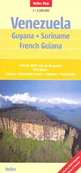
Venezuela with Guyana, Suriname and the French Guiana at 1:2,500,000 from Nelles Verlag, with a smaller size sheet offering a convenient format for use when travelling. Included are street plans and an enlargement of Isla de Margarita. The map is double-sided, showing all but the very southernmost tip of Venezuela on one size, with the other three countries on the reverse. Large overlap means that the Gran Sabana with the Canaima National Park is included on both sides. Vivid relief shading, numerous spot heights and names of mountain ranges, plus graphics for marshlands present the topography. National parks and other protected area are marked.Road network distinguishes between highways in good and poor condition and includes partially paved roads and cart tracks, with distances shown on main routes. Railway lines and local airports are included, and the map also shows internal administrative boundaries with names of the provinces. Numerous places of interest are prominently marked. Latitude and longitude margin ticks are at 2ยฐ intervals. The map has no index of localities. Map legend includes English.Street plans highlighting main places of interest cover central areas of Caracas, Maracaibo, Paramaribo and Cayenne. An enlargement at 1:400,000 shows Isla de Margarita in greater detail.


