Disclosure : This site contains affiliate links to products. We may receive a commission for purchases made through these links.
Venezuela F&B

Detailed, double-sided road map Venezuela, ideal for route-planning. Clearly shows the national road network and selected provincial and local roads, with each class of road clearly indicated and road numbers shown. Intermediate driving distances between locations are shown in kilometres alongside the road, motorway filling stations are shown and motorway junctions are indicated.Topography is shown with relief shading and some spot heights, and colour shading is used to indicate land types. International and provincial boundaries are clearly marked, as are National Parks, nature reserves and restricted military areas. Symbols indicate various sights & locations of tourist interest, such as churches, leisure & sports destinations, panoramas & viewing points, monuments and historic sites. Some hotels and campsites are marked. Railway lines, airports, ports, reefs and marinas are also shown. A grid divides the map at 1ยฐ increments, and is also grid-referenced for the map index.*Multilingual map legend includes English.*

Related Products:
 Greece 700K F&B
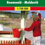 Romania – Moldova F&B
 Germany North F&B
 Bali – Lombok – Komodo F&B
 Vietnam – Laos – Cambodia F&B
 France North F&B
 Pyrenees F&B
 Germany South F&B
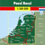 Netherlands F&B
 France South F&B
 South Tyrol – Trentino – Lake Garda – Veneto F&B
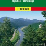 Czech – Slovak Republics F&B
 Slovenia – Croatia – Serbia – Bosnia-Herzegovina – Macedonia – Kosovo – Montenegro F&B
 Alaska F&B
 Carinthia – Northern Adriatic Coast F&B
 Russia – C. I. S. F&B
 Venezuela Reise-Know-How Map
 Germany F&B Motorways Map
 Latvia Regio Manors and Palaces
 China East ITMB
 Saskatchewan Back Road Atlas
 Venezuela ITMB
 Verona City and Province
 Hungary Michelin
 Venezuela, Guyana, Suriname & French Guiana Nelles Map
 Europe Political F&B
 Alberta MapArt Back Road Atlas
 Lisbon Michelin City Plan and Index
 India South Borch
 Finland Michelin
 Belarus Road Atlas
 Czechia Michelin
 Poland Michelin
 Czechia – Slovakia Michelin
 London A-Z M25 / Main Road Wall Map
 Ivory Coast Michelin
 Austria Michelin
 USA NGS Adventure Edition Road Atlas A3 SPIRAL-BOUND
 Amsterdam Michelin City Map
 Czechia – Slovakia Michelin SUPERCEDED