Disclosure : This site contains affiliate links to products. We may receive a commission for purchases made through these links.
Vanoise National Park – Beaufortain Didier Richard 04

Vanoise National Park and the Beaufortain Massif in the French Alps at 1:60,000 on a contoured and GPS compatible map from Didier Richard with a base derived from IGN’s topographic survey, highlighting both local hiking routes and the GR network of long-distance paths, gรฎtes and mountain refuges, interesting natural and cultural sites, etc. The map covers the whole of the Tour de la Vanoise along the GR5 and GR 55. Coverage extends west to beyond Moรปtiers and St-Michel du-Maurienne and south beyond Modane, and includes several popular summer and winter resorts: Tignes, Val d’Isรจre, Les Arc, La Plagne, Mรฉribel, Pralognan-la-Vanoise, Aussois, Valmeinier, Station du Val Cenis, Station du Val Frรฉjus, Bessans, etc.Relief is portrayed by contours at 50m intervals with additional hill shading and colouring for different types of vegetation. An overprint highlights local hiking trails, indicating difficult sections and routes which are part of the GR network. Bold symbols show gรฎtes accessible by car, mountain refuges accessible only on foot, via ferrata sites, mountain bike centres, interesting cultural or natural sites, etc. The map has a UTM grid. Map legend includes English. To see the list of all the titles in this series please click on the series link.

Related Products:
 รcrins Massif National Park Didier Richard 05
 Corsica North Didier Richard 08
 Corsica South Didier Richard 09
 Vercors Didier Richard
 Queyras – Ubaye Didier Richard
 Monts d`Ardรจche Didier Richard
 Mont-Blanc – Annecy Didier Richard 02
France: Didier Richard Hiking Maps of South Eastern France and Corsica
Mont-Blanc – Annecy Didier Richard 02
France: Didier Richard Hiking Maps of South Eastern France and Corsica
 Maures – Esterel Didier Richard 15
 Du Lรฉman ร la Vanoise – par le Mont Blanc et le Beaufortain GR5
 Mont Blanc Pocket Map Edition Didier Richard
 Vanoise Rando Editions
 La Traversee der Alpes La Vanoise – PN de la Vanoise GR5/GR55
 Massif de la Vanoise IGN 75003
 Mercantour & Alpi-Marittime Didier Richard 07
 Trekking in the Vanoise: Tour of the Vanoise and the Tour des Glaciers de la Vanoise
 Bรฉarn – Aspe – Ossau – Pyrenees National Park Rando Editions 3
 Southern Provence: Marseille – Aix-en-Provence – Toulon
 Lake Geneva – Chablais – Faucigny
 Picos de Europa National Park 3-Map and Guide Set CNIG ENGLISH
 Picos de Europa National Park 3-Map and Guide Set CNIG SPANISH
 Beaufortain – Massif du Mont Blanc IGN 75004
Beaufortain Rando Editions
Beaufortain – Massif du Mont Blanc IGN 75004
Beaufortain Rando Editions
 Sierra de Guadarrama National Park 4-Map and Guide Set CNIG
 Stelvio National Park Walking Guide – Italy`s Largest Alpine National Park
 Picos de Europa National Park Short and Long-Distance Trails
 Massif de la Vanoise IGN Wall Map
 Skadar Lake National Park
 Domodossola – Val Grande National Park Swisstopo Hiking 285T
 Les Arcs – La Plagne – PN de la Vanoise IGN 3532ET
 Monti Sibillini National Park Kompass 2474
 Les Arcs – La Plagne – PN de la Vanoise IGN WATERPROOF 3532ETR
 Les Trois Vallees – Modane – PN de la Vanoise IGN 3534OT
 Picos de Europa National Park – Anillo de Picos Adrados Map
 Triglav National Park Kartografija WATERPROOF Hiking Map
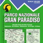 Gran Paradiso National Park IGC 3
 Eifel National Park – Ahrtal K+F Outdoor Map 19
 Galicica National Park
 Elbsandsteingebirge ‘“ Sรคchsische Schweiz National Park K+F Map 18
 Gran Sasso and Monti della Laga National Park Kompass 2476