Disclosure : This site contains affiliate links to products. We may receive a commission for purchases made through these links.
Valmalenco
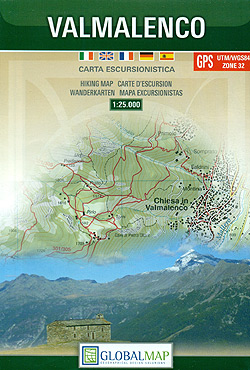
Valmalenco on a double-sided, contoured and GPS compatible map at 1:25,000 from Litografia Artistica Cartografica in their Global Map imprint. Coverage extends from Sondrio and the Adda River northwards to beyond the Swiss border and includes Monte Disgrazia, Pizzo Scalino and the peak of Bernina with the surrounding glaciers.The map has contours at 20m intervals, enhanced by shading and excellent graphic relief for rocky areas, plus colouring for woodlands and glaciers. Local hiking paths are prominently highlighted, indicating where appropriate their numbers, and graded according to the degree of difficulty. Also highlighted are locations of alpine huts and refuges, showing if opened throughout the year. Funiculars and ski lifts are marked. The map has latitude and longitude grid at intervals of 1’. Map legend includes English.

Related Products:
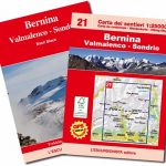 Bernina – Valmalenco – Sondrio L`Escursionista Editore 21
 Bernina – Valmalenco – Sondrio Kompass 93
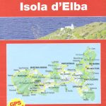 Elba L`Escursionista Editore
 Monte Bianco / Mt Blanc – Courmayeur L`Escursionista Editore 1
 Valsavarenche – Gran Paradiso L`Escursionista Editore 9
 Valle di Cogne – Gran Paradiso L`Escursionista Editore 10
 Monte Rosa – Ayas – Gressoney – Alagna L`Escursionista Editore 8
 Paklenica National Park
 La Thuile ‘“ Piccolo San Bernardo L`Escursionista Editore 2
 Madeira Kompass 234
Valpelline – Saint-Barthรฉlemy L`Escursionista Editore 6
Madeira Kompass 234
Valpelline – Saint-Barthรฉlemy L`Escursionista Editore 6
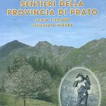 Prato Province Hiking Routes
 Valgrisenche – Val di Rhemes – Valsavarenche L`Escursionista Editore 3
 Val di Champorcher – Mont Avic L`Escursionista Editore 11
Basse valli d`Ayas e del Lys L`Escursionista Editore 12
Italy: L`Escursionista Editore 25K Hiking Maps of the Italian Alps
Val di Champorcher – Mont Avic L`Escursionista Editore 11
Basse valli d`Ayas e del Lys L`Escursionista Editore 12
Italy: L`Escursionista Editore 25K Hiking Maps of the Italian Alps
 Gran San Bernardo – Valle di Ollomont L`Escursionista Editore 5
Alte Valli di Lanzo – Val Grande – Val d`Ala – Val di Viu L`Escursionista Editore 17
Gran San Bernardo – Valle di Ollomont L`Escursionista Editore 5
Alte Valli di Lanzo – Val Grande – Val d`Ala – Val di Viu L`Escursionista Editore 17
 Conca di Aosta – Mont Emilius – Mont Fallere L`Escursionista Editore 4
 Valtournenche – Monte Cervino / Matterhorn – Val d`Ayas West L`Escursionista Editore 7
 Val Soana – Valle di Ribordone – Valle di Locana L`Escursionista Editore 15
 Valle Centrale – Saint-Barthรฉlemy – Saint-Marcel – Val Clavalite L`Escursionista Editore 13
 Valle dell`Orco – Gran Paradiso L`Escursionista Editore 14
 Urzulei
Dora Baltea Canavesana – Valchiusella – Valle Sacra L`Escursionista Editore 16
Urzulei
Dora Baltea Canavesana – Valchiusella – Valle Sacra L`Escursionista Editore 16
 Nationalpark K+F Hiking 16
 Dartmoor for Cyclists
 Alsace – Vosges Central – Strasbourg – Colmar 2-Map Set Kompass 2221
 Cervino – Monte Rosa – Valtourenche – Valle di Champorcher L`Escursionista Editore
Oberengadin – Bernina K+F Hiking 07
Cervino – Monte Rosa – Valtourenche – Valle di Champorcher L`Escursionista Editore
Oberengadin – Bernina K+F Hiking 07
 Alsace – Vosges South – Colmar – Mulhouse 2-Map Set Kompass 2222
Aargau – Wasserschloss Schweiz K+F Hiking 10
Alsace – Vosges South – Colmar – Mulhouse 2-Map Set Kompass 2222
Aargau – Wasserschloss Schweiz K+F Hiking 10
 Alsace – Vosges North – Hagenau – Starsburg 2-Map Set Kompass 2220
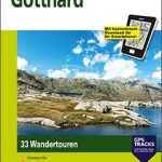 Gotthard
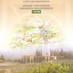 Chianti
 The Bernina Tour: 12 Day Tour in Switzerland and Italy and Tour of Italy`s Valmalenco
 Appenzellerland – Sรคntis
 Heidiland – Flumserberg
 Rhodes F&B
Jungfrau Region – Grindelwald K+F Hiking 4
Rhodes F&B
Jungfrau Region – Grindelwald K+F Hiking 4