Disclosure : This site contains affiliate links to products. We may receive a commission for purchases made through these links.
Categories
-
Best Sellers
-
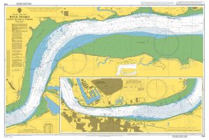
Admiralty Chart 1186 – River Thames – Canvey Island to Tilbury
NEW EDITION OUT ON 26/03/2020Admiralty standard nautical charts comply with Safety of Life at Sea (SOLAS) regulations and are ideal for professional, commercial and recreational use. Read More » -

Admiralty Chart 2669 – Channel Islands and Adjacent Coast of France
NEW EDITION OUT ON 23/04/2020Admiralty standard nautical charts comply with Safety of Life at Sea (SOLAS) regulations and are ideal for professional, commercial and recreational use. Read More » -
Garralda CNIG Topo 116
Topographic coverage of mainland Spain at 1:50,000 in the MTN50 (Mapa Topogrรกfico Nacional) series from the Centro Nacional de Informaciรณn Geografica, the country’s civilian survey organization. Read More » -

Mobile Library
Twelve-year-old Bobby Nusku is an archivist of his mother. He catalogues traces of her life and waits for her to return home. Bobby thinks that he`s Read More » -

LETTER Q Code Signal ( Request Pratique ) Flag – 15 x 12 inch – printed
We are able to source a wide range flags in many sizes, sewn or printed on 100% Ministry Of Defence Standard Woven and Knitted Polyester. Flags Read More » -

Ben Klibreck & Ben Armine OS Explorer Map 443 (paper)
Ben Klibreck and Ben Armine area on a detailed topographic and GPS compatible map No. 443, paper version, from the Ordnance Survey’s 1:25,000 Explorer series.MOBILE DOWNLOADS: Read More » -

Lola`s: A Cake Journey Around the World
Discover 70 popular cakes from across the globe, brought to you by London`s famous bakery. From American and Middle Eastern delicacies to European delights – bake Read More » -

Rotterdam Falkplan Citymap & More
Central Rotterdam in a series of handy size, detailed and indexed city centre street plans of main towns in the Netherlands and Flanders including Brussels from Read More » -
Maresme ICGC 21
Topographic survey of Catalonia at 1:50,000 from the Institut Cartogrร fic de Catalunya, with vivid presentation of the terrain and an overprint for long-distance GR hiking trails. Read More » -

Longuรฉ-Jumelles – Beaufort-en-Vallรฉe IGN 1622SB
Topographic survey of France at 1:25,000 in IGN`s excellent TOP25 / Sรฉrie Bleue series. All the maps are GPS compatible, with a 1km UTM grid plus Read More »
-


