Disclosure : This site contains affiliate links to products. We may receive a commission for purchases made through these links.
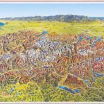
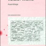
Valais / Wallis Hallwag Panorama Map
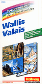
Beautiful panorama drawing of the canton, viewed looking southwards from the peaks of the Bernese Oberland across the Rhone Valley towards the highest part of the Swiss Alps, with the Italian and French Alps in the background. Each valley and mountain is clearly visible. Names and altitude are indicated for numerous peaks. The map also shows the railway network, with towns and villages. Excellent for planning or retracing journeys across this wonderful landscape.

Related Products:
 Switzerland Hallwag Panorama Map
Ticino Hallwag Panorama Map
Lucerne – Central Switzerland Hallwag Panorama Map
Switzerland Hallwag Panorama Map
Ticino Hallwag Panorama Map
Lucerne – Central Switzerland Hallwag Panorama Map
 Bernese Oberland Hallwag Panorama Map
 Graubรผnden Hallwag Panorama Map
 Switzerland, My Holiday Map
 Alps in Summer Panorama Wall Map
 Valais / Wallis Swisstopo 105
 Valais Walking Guide- 120 Walks and Treks
 South Tyrol – Dolomites Tabacco Road and Panorama Map
 Dolomites ‘“ Lake Garda ‘“ Verona – Venice 200K Tabacco Road & Panorama Map
Lake Constance F&B Leisure & Panorama
Dolomites ‘“ Lake Garda ‘“ Verona – Venice 200K Tabacco Road & Panorama Map
Lake Constance F&B Leisure & Panorama
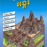 Angkor Gecko Panorama Map
 Lower Valais – Sion K+F Cycling Map 20
 Ireland Hallwag Road Map
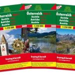
 Austria Freytag & Berndt Panorama Wall Map
 Great Lakes USA 03 Hallwag Road Map
 Switzerland Hallwag Touring Atlas
 Upper Valais / Oberwallis K+F Cycling Map 21
 North Central – Great Plains USA 02 Hallwag Road Map
 Engadine – St Moritz Hallwag Mountain Bike Map 11
 Deep South USA 10 Hallwag Road Map
 Austria F&B Road Map Set
 Florida USA 11 Hallwag Road Map
 Texas USA 09 Hallwag Road Map
 Austria F&B 3-Map Set
 Pacific Northwest USA 01 Hallwag Road Map
 South Central USA 07 Hallwag Road Map
Switzerland Hallwag New Travel Map
South Central USA 07 Hallwag Road Map
Switzerland Hallwag New Travel Map
 New England – Atlantic Northeast USA 04 Hallwag Road Map
 Southwest – Southern Rockies USA 06 Hallwag Road Map
 California – Nevada USA 05 Hallwag Road Map
 USA: Hallwag Regional Road Maps
 Switzerland Hallwag City Atlas
Tectonic Map of Switzerland
Switzerland Hallwag City Atlas
Tectonic Map of Switzerland
 Southeast – Middle Atlantic USA 08 Hallwag Road Map
Geological Map of Switzerland
Southeast – Middle Atlantic USA 08 Hallwag Road Map
Geological Map of Switzerland
 Catalonia Auotomous Community CNIG Physical Road Map
 Europe Hallwag Navigator Road Atlas