Disclosure : This site contains affiliate links to products. We may receive a commission for purchases made through these links.
V&A Bookaroo Notebook Sundour Pheasant A5

Related Products:
 V&A Bookaroo Little Notebook Sundour Pheasant A6
V&A Bookaroo Pen Pouch Sundour Pheasant
V&A Bookaroo Tech-Tidy Sundour Pheasant
V&A Bookaroo Phone Pocket Sundour Pheasant
V&A Bookaroo Glasses Case Sundour Pheasant
V&A Bookaroo Notebook Morris Tulip & Willow A5
V&A Bookaroo Notebook Kilburn Black Floral A5
V&A Bookaroo Little Notebook Morris Tulip & Willow A6
V&A Bookaroo Little Notebook Kilburn Black Floral A6
V&A Bookaroo Little Notebook Sundour Pheasant A6
V&A Bookaroo Pen Pouch Sundour Pheasant
V&A Bookaroo Tech-Tidy Sundour Pheasant
V&A Bookaroo Phone Pocket Sundour Pheasant
V&A Bookaroo Glasses Case Sundour Pheasant
V&A Bookaroo Notebook Morris Tulip & Willow A5
V&A Bookaroo Notebook Kilburn Black Floral A5
V&A Bookaroo Little Notebook Morris Tulip & Willow A6
V&A Bookaroo Little Notebook Kilburn Black Floral A6
 Moleskine Time Notebook Limited Collection Black Large Ruled Notebook Hard
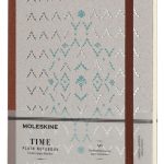 Moleskine Time Notebook Limited Collection Brown Large Plain Notebook Hard
 The Writing Notebook: City: The Notebook for Your Next Book
 Bookaroo Tool Belt Red
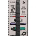 Bookaroo Tool Belt Charcoal
V&A Bookaroo Pen Morris Tulip & Willow
V&A Bookaroo Pen Kilburn Black Floral
Bookaroo Tool Belt Charcoal
V&A Bookaroo Pen Morris Tulip & Willow
V&A Bookaroo Pen Kilburn Black Floral
 Bookaroo Travel Tech-Tidy – Black
 Bookaroo Travel Tech-Tidy – Brown
Bookaroo Books & Stuff Pouch Brown
Bookaroo Books & Stuff Pouch Turquoise
Bookaroo Books & Stuff Pouch Forest Green
Bookaroo Books & Stuff Pouch Pale Pink
V&A Bookaroo Tech-Tidy Morris Tulip & Willow
V&A Bookaroo Tech-Tidy Kilburn Black Floral
V&A Bookaroo Phone Pocket Morris Tulip & Willow
V&A Bookaroo Phone Pocket Kilburn Black Floral
V&A Bookaroo Glasses Case Morris Tulip& Willow
V&A Bookaroo Glasses Case Kilburn Black Floral
Bookaroo Travel Tech-Tidy – Brown
Bookaroo Books & Stuff Pouch Brown
Bookaroo Books & Stuff Pouch Turquoise
Bookaroo Books & Stuff Pouch Forest Green
Bookaroo Books & Stuff Pouch Pale Pink
V&A Bookaroo Tech-Tidy Morris Tulip & Willow
V&A Bookaroo Tech-Tidy Kilburn Black Floral
V&A Bookaroo Phone Pocket Morris Tulip & Willow
V&A Bookaroo Phone Pocket Kilburn Black Floral
V&A Bookaroo Glasses Case Morris Tulip& Willow
V&A Bookaroo Glasses Case Kilburn Black Floral
 Bookaroo Pen Holder – Red
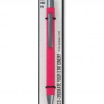 Bookaroo Pen – Hot Pink
 Bookaroo Pen – Lilac
 Bookaroo Pen – Purple
 Bookaroo Pen – Orange
 Bookaroo Pen – Navy
 Bookaroo Pen – Mustard
 Bookaroo Pen – Grey
 Bookaroo Pen – Black
 Bookaroo Pen – Gold
 Bookaroo Pen – Turquoise
 Bookaroo Pen – Forest Green