Disclosure : This site contains affiliate links to products. We may receive a commission for purchases made through these links.
USA Southeast Reise Know-How
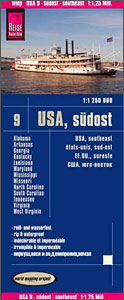
South-Eastern USA at 1:1,250,000 in a series of waterproof and tear-resistant, indexed regional maps of USA from Reise Know-How’s highly acclaimed World Mapping Project, combining detailed presentation of the road network with topographic and tourist information. The map is double-sided to provide the best balance between detailed scale and a convenient size sheet, dividing the region east/west. Coverage on the eastern side extends from Baltimore and Washington DC to Orlando and Disney World, and on the reverse extending westwards to beyond Little Rock, AK, and north to St. Louis.Maps in this series have altitude colouring with spot heights to show each region’s topography, with national parks and other protected areas, as well as American Indian Reservations and restricted entry zones clearly marked. Road network indicates toll roads and scenic routes. Driving distances are shown in miles. Railways and, where appropriate, ferry routes are marked. The maps show both names and boundaries of local counties. Symbols highlight a variety of places of interest, including historical sites, amusement parks, natural features, golf courses and wintersport areas, etc. Each map includes an index of localities and has a latitude and longitude grid (in this title at intervals of 1ยฐ). Map legend includes English.To see other titles in this series please click on the series link.

Related Products:
 USA North-Eastern: Maine to WashingtoN DC (CT, DE, ME, MD, MA, NH, NJ, NY, OH, PA, RI, VT, WV) Reise-Know-How Map
 USA Midwest – IL, IN, IA, MI, MN, MO, WI Reise Know-How
 Alaska Reise Know-How
 Florida Reise Know-How
 USA Southwest Reise Know-How
 Hawaii Reise Know-How
 USA North – ID, MT, NE, ND, SD, WY Reise Know-How
 USA South-Central: Kansas – Oklahoma – Texas Reise-Know-How Map
 New England Reise Know-How
 USA Northwest – OR, WA Reise Know-How
 California Reise Know-How
 Poland Southeast Reise Know-How
 USA: Reise Know-How Regional Touring Maps
 Azerbaijan Reise Know-How
 India Northeast Reise Know-How
 Iran Reise Know-How
 Sri Lanka Reise Know-How
 Istria Reise Know-How
 Bosnia-Herzegovina – Montenegro Reise Know-How
 Guatemala – Belize Reise Know-How
 Poland Southwest Reise Know-How
 Canada East Reise Know-How
 China East – North and South Korea Reise Know-How
 Albania Reise Know-How
 Sweden Southeast – Stockholm – Uppsala – Norrkoping F&B
 Southeast – Middle Atlantic USA 08 Hallwag Road Map
 Norway South Reise Know-How
 Lithuania Reise Know-How
 Baltic States Reise Know-How
 Pakistan Reise Know-How
 Africa West – Sahara Reise Know-How
 Mexico Reise Know-How
 Poland: Reise-Know-How Touring Maps with Historic Place Names
 Ukraine Reise Know-How
 Canada Central: Western Ontario, Manitoba, Saskatchewan Reise-Know-How Map
 China West Reise Know-How
 Uzbekistan Reise Know-How
 Mallorca East Reise Know-How
 South Africa Reise Know-How
 Taiwan Reise Know-How