Disclosure : This site contains affiliate links to products. We may receive a commission for purchases made through these links.
USA: Reise Know-How Regional Touring Maps
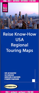
Light, waterproof and tear-resistant, indexed regional maps of USA from Reise Know-Howโ€s highly acclaimed World Mapping Project, combining detailed presentation of the road network with topographic and tourist information. Altitude colouring with spot heights shows each regionโ€s topography, with national parks and other protected areas, as well as American Indian Reservations and restricted entry zones clearly marked. Road network indicates toll roads and scenic routes. Driving distances are shown in miles. Railways and, where appropriate, ferry routes are marked. The maps show both names and boundaries of states andl counties.Symbols highlight a variety of places of interest, including historical sites, amusement parks, natural features, golf courses and wintersport areas, etc. Each map is double-sided, includes an index of localities, and has a latitude and longitude grid. Map legend includes English.

Related Products:
 Poland: Reise-Know-How Touring Maps with Historic Place Names
 Indonesia: Reise-Know How Regional Maps
 Italy: Touring Club Italiano 200K Regional Road Maps
 Spain: Reise Know-How Walking and Touring Maps of Mallorca
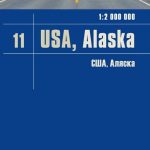 Alaska Reise Know-How
 Hawaii Reise Know-How
 USA Northwest – OR, WA Reise Know-How
 Canada: Reise Know-How Regional Road Maps
 New England Reise Know-How
 Florida Reise Know-How
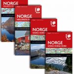 Norway: Norstedts Regional Road Maps
 Italy: Touring Club Italiano 400K Road Maps
 France: AA Regional Touring Maps
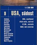 USA Southeast Reise Know-How
 USA South-Central: Kansas – Oklahoma – Texas Reise-Know-How Map
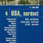 USA North-Eastern: Maine to WashingtoN DC (CT, DE, ME, MD, MA, NH, NJ, NY, OH, PA, RI, VT, WV) Reise-Know-How Map
 USA North – ID, MT, NE, ND, SD, WY Reise Know-How
 California Reise Know-How
 USA Midwest – IL, IN, IA, MI, MN, MO, WI Reise Know-How
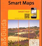 Italy: Touring Club Italiano Regional Smart Maps
 USA Southwest Reise Know-How
 Sweden: Freytag & Berndt Regional Road Maps
 India: Reise Know-How Regional Road Maps
 Latvia: Jana Seta 200K Regional Touring Maps
 Norway: Cappelen Regional Road Maps
 Argentina: Firestone Regional Road Maps
USA: Michelin Regional Road Maps
Argentina: Firestone Regional Road Maps
USA: Michelin Regional Road Maps
 Norway: Freytag & Berndt Regional Road Maps
 Sweden: Norstedts Regional Road Maps
 Great Britain: AA Regional Road Maps
 Italy: Michelin 400K Touring Maps
 Greece: Terrain Editions 100K Touring Maps of Crete
 Spain: CNIG 500K Regional Road Maps
 France: IGN 350K Touring Maps (2016 editions)
 USA: Hallwag Regional Road Maps
 Lithuania: Jana Seta 200K/250K Regional Touring Maps
 China: GiziMap Regional Maps
 Poland: Michelin Regional Road Maps