Disclosure : This site contains affiliate links to products. We may receive a commission for purchases made through these links.
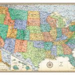
USA Rand McNally Signature Wall Map PAPER
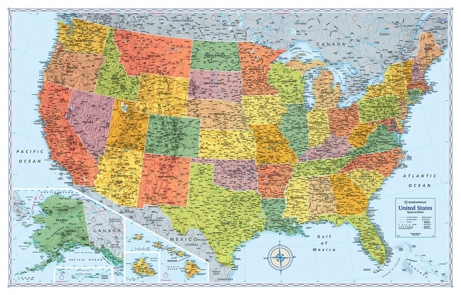
Signature edition wall map of USA, size 127 x 81.5cm (50″ x 32″) from Rand McNally presenting the states in bright colours and with their boundaries clearly delineated in white. The map indicates state capitals and shows the network of limited access and selected other major highways. Also marked are time zone boundaries. Relief shading shows the topography with major rivers and lakes, names of mountain ranges and peaks, plus highlighting for national parks/monuments/recreational areas. Alaska and Hawaii are included on insets. The map has latitude and longitude lines at 4ยบ intervals.PLEASE NOTE: the same information is shown on Rand McNally’s Classic edition wall map of USA with states in more muted colours and the surrounding seas in beige.

Related Products:
 USA Rand McNally Signature Wall Map ENCAPSULATED
 USA Rand McNally Classic Wall Map PAPER
 USA Rand McNally Classic Wall Map ENCAPSULATED
 World Rand McNally Signature Wall Map PAPER
 World Rand McNally Signature Wall Map ENCAPSULATED
 World Rand McNally Classic Wall Map PAPER
 Alaska Easy to Fold Rand McNally
 Alaska Easy-to-Read Rand McNally
 Hawaii Easy-to-Read Rand McNally
 World Rand McNally Classic Wall Map ENCAPSULATED
 Utah Easy-to-Read Rand McNally
 United States NGS National Parks Wall Map PAPER
 Kentucky Easy-to-Read Rand McNally
 Nevada Easy-to-Read Rand McNally
 Tennessee Easy to Fold Rand McNally
 Idaho Easy to Fold Rand McNally
 Iowa Easy to Fold Rand McNally
 Texas Easy to Fold Rand McNally
 Mississippi Easy to Fold Rand McNally
 Arkansas Easy to Fold Rand McNally
 Oklahoma Easy to Fold Rand McNally
 Michigan Easy to Fold Rand McNally
 Illinois Easy to Fold Rand McNally
 Indiana Easy to Fold Rand McNally
 Arizona Easy to Fold Rand McNally
 Massachusetts Easy to Fold Rand McNally
 Washington Easy to Fold Rand McNally
 Minnesota Easy to Fold Rand McNally
 Maine Easy to Fold Rand McNally
 Colorado Easy to Fold Rand McNally
 Louisiana Easy to Fold Rand McNally
 New Jersey Easy to Fold Rand McNally
 Georgia Easy to Fold Rand McNally
 Pennsylvania Easy to Fold Rand McNally
 Wisconsin Easy to Fold Rand McNally
 Oregon Easy to Fold Rand McNally
 Virginia Easy to Fold Rand McNally
 New Mexico Easy to Fold Rand McNally
 North Carolina Easy to Fold Rand McNally
 Delaware & Maryland Easy to Fold Rand McNally