Disclosure : This site contains affiliate links to products. We may receive a commission for purchases made through these links.
USA Rand McNally Midsize Road Atlas 2020 PAPERBACK
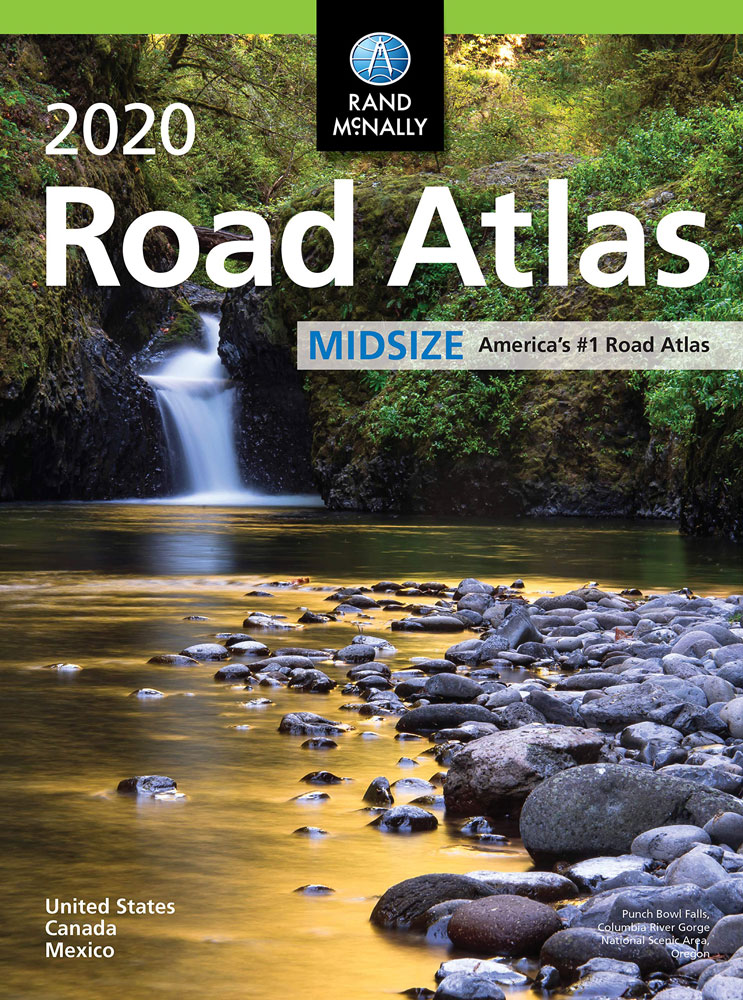
The most trusted and best-selling US atlas on the market made portable!. This updated North American atlas contains maps of every U.S. state and Canadian province, an overview map of Mexico, plus detailed maps of over 50 North American cities, all conveniently packaged for travel. Contains mileage chart showing distances between 77 cities and national parks with driving times map.Rand McNally presents six of our favorite national parksbig and small, east and westthat showcase this country`s astonishing beauty, highlight essential visitor information, and offer insightful travel tips.Road construction and conditions phone numbers and websitesTourism phone numbers and websitesHotel phone numbers and websitesTo see all the formats of Rand McNally’s USA Road Atlases please click on the series link.

Related Products:
 USA Rand McNally Midsize Road Atlas 2022 PAPERBACK
USA Rand McNally Road Atlas 2022 A3 PAPERBACK
USA Rand McNally EasyFinder Road Atlas 2022 A4 SPIRAL-BOUND
USA Rand McNally Road Atlas with Protective Vinyl Cover 2022 A3 PAPERBACK
USA Rand McNally Compact Road Atlas 2021
USA Rand McNally Road Atlas & National Park Guide 2022 A3 SPIRAL-BOUND
USA Rand McNally Large Scale Road Atlas 2022 A3 SPIRAL-BOUND
USA Rand McNally Midsize Road Atlas 2022 PAPERBACK
USA Rand McNally Road Atlas 2022 A3 PAPERBACK
USA Rand McNally EasyFinder Road Atlas 2022 A4 SPIRAL-BOUND
USA Rand McNally Road Atlas with Protective Vinyl Cover 2022 A3 PAPERBACK
USA Rand McNally Compact Road Atlas 2021
USA Rand McNally Road Atlas & National Park Guide 2022 A3 SPIRAL-BOUND
USA Rand McNally Large Scale Road Atlas 2022 A3 SPIRAL-BOUND
 North Carolina Easy to Fold Rand McNally
 USA: Rand McNally Road Atlases 2018
 North Dakota & South Dakota Easy to Fold Rand McNally
 Tennessee Easy to Fold Rand McNally
 Idaho Easy to Fold Rand McNally
 Iowa Easy to Fold Rand McNally
 Texas Easy to Fold Rand McNally
 Mississippi Easy to Fold Rand McNally
 Arkansas Easy to Fold Rand McNally
 Oklahoma Easy to Fold Rand McNally
 Michigan Easy to Fold Rand McNally
 Illinois Easy to Fold Rand McNally
 Indiana Easy to Fold Rand McNally
 Arizona Easy to Fold Rand McNally
 Massachusetts Easy to Fold Rand McNally
 San Diego CA Rand McNally
 Washington Easy to Fold Rand McNally
 Raleigh – Durham NC Rand McNally
 Minnesota Easy to Fold Rand McNally
 Alaska Easy to Fold Rand McNally
 Maine Easy to Fold Rand McNally
 Colorado Easy to Fold Rand McNally
 Louisiana Easy to Fold Rand McNally
 New Jersey Easy to Fold Rand McNally
 Georgia Easy to Fold Rand McNally
 Pennsylvania Easy to Fold Rand McNally
 Wisconsin Easy to Fold Rand McNally
 Oregon Easy to Fold Rand McNally
 Virginia Easy to Fold Rand McNally
 New Mexico Easy to Fold Rand McNally
 Delaware & Maryland Easy to Fold Rand McNally
 New York Easy to Fold Rand McNally
 Kansas & Nebraska Easy to Fold Rand McNally