Disclosure : This site contains affiliate links to products. We may receive a commission for purchases made through these links.
USA Pacific Northwest ITMB
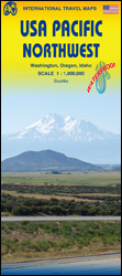
The Pacific Northwest states: Oregon, Washington State and Idaho, on a double-sided, indexed road map at 1:1,000,000 with altitude colouring to show the topography, printed on light, waterproof and tear-resistant synthetic paper.The map divides the region east-west, with a small overlap between the sides, and extends to Helena and Great Falls in Montana. Geography is presented by altitude colouring and spot heights (in feet), plus names of various mountain ranges, peaks, and other topographic features. National parks and Indian reservations are highlighted. The map shows the region’s road network emphasizing the inter-state highways, and includes railway lines. Symbols indicate various places of interest including numerous campsites. Latitude and longitude lines are drawn at 1ยฐ intervals. The map also includes a large inset with a street plan of central Seattle highlighting numerous places of interest.To see other regional titles from ITMB covering USA please click on the series link.


