Disclosure : This site contains affiliate links to products. We may receive a commission for purchases made through these links.
USA: Michelin Zoom Maps
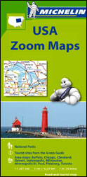
Scenic regions of USA on exceptionally clear and well presented, indexed road maps from Michelin at 1:1,267,200 (1โ€ to 20 miles), with highlighting of All-American Roads and National Byways, Michelinโ€s selections of best sights and scenic routes, street plans of main cities, events calendars and other tourist information. Each map covers a large area, presenting its topography by unobtrusive background shading with plenty of names of mountain ranges, valley, deserts, etc. Peak heights are given in feet. Colouring highlights national/state forests and other protected areas, Indian lands, and restricted entry military zones. Road network clearly distinguishes between free and toll routes and indicates toll barriers, interchange numbers, services, rest areas and Travel Centers. Road numbers are clearly marked on all types of roads and driving distances, in miles, are shown on interstate, main state and selected provincial routes. The maps show state borders and the time zone boundaries. Symbols indicate campsites, sights recommended in Michelinโ€s Green Guides and other places of interest. The maps have latitude and longitude lines at 1ยบ intervals. The index, arranged by state, is next to the map and also provided is a separate list of sights from the Green Guides annotated with their star ratings.Each map also contains street plans of main cities highlighting places of interest, a month-by-month list of events and celebrations, contact details for national parks, plus a distance table in both miles and kilometres.

Related Products:
 Great Lakes Michelin Zoom 173
 Texas – Oklahoma Michelin Zoom 176
 Pacific Northwest – Washington – Oregon Michelin Zoom 171
 Southern Rockies – Arizona – Colorado – New Mexico – Utah Michelin Zoom 175
 Deep South – Mississippi to Florida Michelin Zoom 177
 Spain: Michelin Zoom Espaรฑa Road Maps
 Bordeaux and surrounding Area Michelin Zoom 126
 USA: Michelin Regional Road Maps
 Toulouse and Surrounding Area Michelin Zoom 129
 Great Britain: Michelin 400K Road Maps
 Chateaux of the Loire Michelin Zoom 116
 France: Michelin Zoom Maps of Popular Holiday Areas
 Black Forest – Alsace – Rhine Valley Michelin Zoom 131
 Perigord – Quercy Michelin Zoom 118
 Switzerland: Michelin 200K Road Maps
 Basque Coast – South Landes Michelin Zoom 133
Michelin City Maps
Basque Coast – South Landes Michelin Zoom 133
Michelin City Maps
 Environs of Paris Michelin Zoom 106
France: Michelin 150K Local Road Maps
Environs of Paris Michelin Zoom 106
France: Michelin 150K Local Road Maps
 USA: NGS State Maps
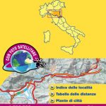
 Italy: Michelin 400K Touring Maps
 France: Michelin 200K Regional Road Maps
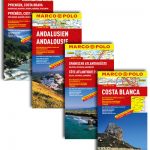
 Spain: Michelin Regional Road Maps
 Benelux: Michelin Regional Road Maps and Atlases
 Portugal: Michelin Regional Road Maps
 Italy: Michelin 200K Regional Road Maps
 France: Michelin 500K Road Maps
 Germany: Michelin Regional Road Maps
 Spain: Mairdumont 300K Regional Road Maps
 Great Britain: Michelin Regional Tourist Maps
 Northern England – Midlands Michelin Regional 502
 Mexico: Ed. Independecia State Road Maps and Street Plans
 Italy Central Michelin Regional 563
 Australia: UBD Gregory`s Regional Road Maps
 Corsica Michelin Local 345
 Andalucia Michelin Regional 578
 Scotland Michelin Regional 501 WATERPROOF
 Wales – South West England – Midlands Michelin Regional 503
 Scotland Michelin Regional 501
 Aragon – Catalonia Michelin Regional 574