Disclosure : This site contains affiliate links to products. We may receive a commission for purchases made through these links.
USA Interstate Rand McNally
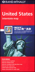
Rand McNally’s road map of the whole of USA presenting the country’s network of free and toll interstate highways plus US and state/provincial highways on a base highlighting national parks or forests and Indian Reservations. Also marked is a selection of other important places of interest. The index, arranged by state, is on the reverse.The main map does not indicate the country’s topography, but on the reverse a separate smaller map shows the physical geography. The reverse side also provides a mileage/driving times map of the US, a mileage table, a table with prices charged on toll roads, plus a list with the main tourist information centre for each state.To see other titles in this series please click on the series link.


