Disclosure : This site contains affiliate links to products. We may receive a commission for purchases made through these links.
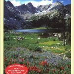
USA: Earthwalk Press Hiking Maps
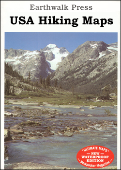
Hiking areas mainly in the western USA on detailed, contoured maps from Earthwalk Press with cartography based on the USGS topographic survey of the country plus additional information for visitors, printed on light, waterproof and tear-resistant synthetic paper.Contour interval is usually 40 feet and all heights are also given in feet. Colouring shows forested areas, plus, where necessary, additional graphics indicate other important topographic features such as marshland/swamps, moraine, etc. Hiking trails are highlighted, showing where appropriate their trail numbers and/or names. Icons highlight locations of trailheads, campgrounds, picnic areas, ranger stations, plus where available other recreational facilities. Local road network indicates light duty and unimproved dirt roads. GPS coordinates are given as margin ticks.Each title includes comprehensive additional text with useful information, including weather and water warning, regulations, etc, usually prepared by local summer rangers with good knowledge of the area.

Related Products:
 Sawtooth Wilderness, ID
 Lassen Volcanic National Park, CA
 Whiskeytown – Shasta – Trinity National Recreational Area CA
 Southern Wind River Range: Elkhart Pass to Big Sandy, WY
 North Wind River Range
Great Smoky Mountains National Park, NC/TN
Anza-Borrego Desert Region, CA
North Wind River Range
Great Smoky Mountains National Park, NC/TN
Anza-Borrego Desert Region, CA
 Norway: Turkart 50K Topographic Hiking Maps
 Canada: NGS Trails Illustrated Maps of Banff and Jasper
 Norway: Turkart 100K Topographic Hiking Maps
South Africa: Slingsby Maps Hiking Maps of the Cape Peninsula
Norway: Turkart 100K Topographic Hiking Maps
South Africa: Slingsby Maps Hiking Maps of the Cape Peninsula
 Norway: Turkart 25K Topographic Hiking Maps
 Serbia/Montenegro: Geokarta Hiking and Recreational Maps
 Nepal: Nepa Trekking and Hiking Maps
 Poland: Compass Hiking Maps
 Hungary: Cartographia Hiking Maps
 Bulgaria: Domino Hiking Maps
 Greece: Terrain Editions Maps for Hiking and Recreational Pursuits
USA: Benchmark Maps State Road Maps
Greece: Terrain Editions Maps for Hiking and Recreational Pursuits
USA: Benchmark Maps State Road Maps
 Slovenia: Kartografija 75K Hiking Maps
 Poland: ExpressMap Hiking Maps
 Germany: Kรผmmerly+Frey Hiking and Recreational Maps
 Austria/Germany/Slovenia: Kompass Hiking Maps
 Romania: Dimap Hiking Maps
 France: IGN Hiking, Cycling & Other Recreational Maps
 Austria: Freytag & Berndt Hiking Maps
 Spain: Editorial Piolet Hiking Maps
 Canada: Gem Trek Hiking Maps of the Banff & Jasper National Parks & the Canadian Rockies
 Iceland: Topographic Hiking and Tourist Maps
USA: Trails Illustrated Maps of National Parks, Forest and Other Recreational Areas
Iceland: Topographic Hiking and Tourist Maps
USA: Trails Illustrated Maps of National Parks, Forest and Other Recreational Areas
 USA: Great Pacific Recreation & Travel Maps of the Pacific Northwest
 Iceland: Mรกl og Menning Touring and Hiking Maps
 Ireland: EastWest Mapping Hiking Maps of the Wicklow Mountains
 Romania: Bel Alpin Hiking Maps
 South Africa: 50K Hiking Maps of the Drakensberg Mountains
 Switzerland: Swiss Survey 50K/33K Hiking Editions of Topographic Maps
 USA: GTR Mapping Recreational Maps of Rocky Mountain States
 Slovenia: Kompass 75K Hiking and Cycling Maps
Slovenia: Alpine Club 50K and 25K Hiking Maps
Slovenia: Kompass 75K Hiking and Cycling Maps
Slovenia: Alpine Club 50K and 25K Hiking Maps