Disclosure : This site contains affiliate links to products. We may receive a commission for purchases made through these links.
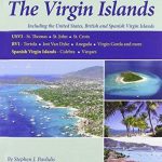
US Virgin Islands Adventure and Dive Map/Guide

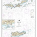
US Virgin Islands Adventure and Dive Map/Guide at 1:125,000 from Franko`s Maps printed on light, waterproof and tear-resistant synthetic paper, with a wealth of information for scuba diving and snorkeling, plus other tourist information.The map shows on one side are St. Thomas with a street plan of Charlotte Amalie and St. John with enlargements presenting Cruz Bay and Coral Bay in greater detail; on the reverse is St. Croix, accompanied by street plans of Fredriksted and Christiansted. Numerous scuba diving sites, both around the coast of these four main islands and further offshore, are prominently highlighted and accompanied by notes indicating depths and other relevant information. On land the map shows each island’s road network and highlights beaches, snorkeling sites, campsites and lodgings, and various points of interest. Also indicated are ferry connections. Latitude and longitude lines are drawn at 2` intervals. The map is decorated with lovely colour drawings of numerous species of fish and coral found in the coastal waters of the Virgin Islands.


