Disclosure : This site contains affiliate links to products. We may receive a commission for purchases made through these links.
US / Mexico Border ITMB
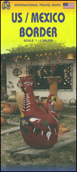
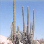
The border between USA and Mexico with the adjoining regions on both sides on a map at 1:1,390,000 from ITMB with altitude colouring presenting the topography. The map is double-sided, with a very small overlap between the sides, and extends north within US to La Vegas and Houston, and in Mexico southwards to cover about half of the Baja California peninsula and along the Gulf of Mexico coast to Tampico.Altitude colouring with spot heights (both in feet) shows the topography, with names of mountain ranges, etc. Road network indicates toll routes and border crossing points are clearly marked. Within Mexico the map also shows locations of petrol stations. Railway lines are included, local airports are marked, as is the time zone boundary. Various places of interest are highlighted, including campgrounds and in Mexico hotels in isolated locations. Latitude and longitude lines are drawn at 2ยฐ intervals. Each side had a separate index.

Related Products:
 Mexico ITMB
 Mexico Border States: Coahuila, Nuevo Leon, Tamaulipas ITMB
 San Diego & USA South West Border ITMB
 Mexico Central & Mexico City ITMB
 Mexico Pacific Coast & Guadalajara ITMB
 Mexico Pacific & Guadalajara ITMB
 Mexico North ITMB
 Mexico North-East ITMB
 Mongolia ITMB
 Arizona & New Mexico ITMB
 Africa Northwest ITMB
 Utah & Colorado ITMB
 Togo & Benin ITMB
 Africa North ITMB
 Uganda ITMB
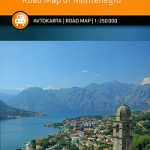 Montenegro
 Patagonia & Tierra del Fuego ITMB
 US/Canada Border ITMB
 Rocky Mountains Canada and US ITMB
 Belarus ITMB
 Africa East & Central ITMB
 Rio San Juan: Nicaragua – Costa Rica Border Regions
 Yukon & Northwest Territories South West ITMB
 Sri Lanka & India South ITMB
 Kenya ITMB
 Tibet ITMB
 Gibraltar – Strait of Gibraltar ITMB
 Cuba West ITMB
 Yucatan ITMB
 Venezuela ITMB
 Alaska ITMB
 Slovenia, Croatia and Bosnia-Herzegovina
 Panama ITMB
 Mexico Reise Know-How
 Paraguay – Bolivia South ITMB
 Ghana ITMB
 Central America – Caribbean Islands – Mexico
 Pakistan ITMB
 Mexico NGS Adventure Map 3108