Disclosure : This site contains affiliate links to products. We may receive a commission for purchases made through these links.
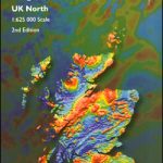
United Kingdom North BGS Bedrock Geology Map
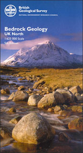
A geological map at 1:625,000 from the British Geological Survey showing bedrock geology of the northern part of the United Kingdom. Coverage extends south to Lancaster and Bridlington Bay (British National Grid line 460km north) and overlaps generously with the Southern UK sheet. Orkney Islands, Shetland Islands, and the remote islands Rockall, Sule Skerry, Stack Skerry, Sula Sgeir and Rona are shown on insets. Current 7th edition was published in 2007.Map detail is generalised from the 1:50,000 map data and shows the distribution of bedrock types as they would appear if the superficial sediment deposits from the last 2 million years or so were eliminated. Geological boundaries and faults are marked along with indications of the relative direction of movement on strike-slip faults and the hanging wall side of thrust faults. The base map indicates selected place names, rivers and main roads. A detailed legend identifies the sedimentary, igneous and metamorphic rocks all classified according to Era, Period and Epoch. A red overprint indicates the sheet lines of the One-Inch and 1:50,000 Geological series by the BGS, with the special district sheets accentuated. National grid lines are drawn at 10km intervals and margin ticks show latitude and longitude at 30’ intervals. A cross-section profile diagram is also included.PLEASE NOTE: this is a folded version of this map, which is also available as a wall map or, alternatively, as a set together with an 88-page explanatory booklet ‘“ to see all the options please click on the series link.


