Disclosure : This site contains affiliate links to products. We may receive a commission for purchases made through these links.
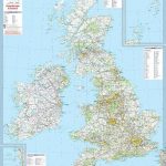
United Kingdom Global Mapping Political A3 Wall Map
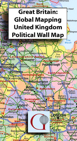
A3-sized political wall map of the United Kingdom at 1:2,525,000 from Global Mapping, showing counties in clear, bold colouring, with major towns and cities easy to spot.Road detail shows motorways, A roads and B roads, all without their numbers marked; railway lines and airports are indicated. Separate insets show the Channel and Shetland Islands at the same scale as the main mapping. Some towns are marked on the map as numbers, with keys at the edge of the map shwowing the numbers and their relevant town names.

Related Products:
 British Isles Global Mapping Political Wall Map ENCAPSULATED
British Isles Global Mapping Political Wall Map SMALL PAPER
British Isles Global Mapping Political Wall Map ENCAPSULATED
British Isles Global Mapping Political Wall Map SMALL PAPER
 United Kingdom & Ireland Schofield & Sims Wall Map
 South East Asia Global Mapping Political Wall Map PAPER
 World Global Mapping Antique Political Wall Map LARGE PAPER
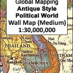
 World: Global Mapping Antique Style Political Wall Maps
 British Isles Political Wall Map PAPER
 World Global Mapping Political Wall Map LARGE PAPER
 South America Global Mapping Political Wall Map PAPER
World Global Mapping Political Wall Map LARGE ENCAPSULATED
World Global Mapping Political Wall Map MEDIUM ENCAPSULATED
World Global Mapping Political Wall Map MEDIUM PAPER
South America Global Mapping Political Wall Map PAPER
World Global Mapping Political Wall Map LARGE ENCAPSULATED
World Global Mapping Political Wall Map MEDIUM ENCAPSULATED
World Global Mapping Political Wall Map MEDIUM PAPER
 World Global Mapping Political Wall Map X-LARGE ENCAPSULATED
World: Global Mapping Political Wall Maps
World Global Mapping Political Wall Map X-LARGE ENCAPSULATED
World: Global Mapping Political Wall Maps
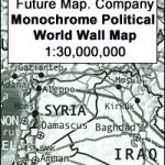 Future Mapping Company Monochrome Political World Wall Map PAPER
 Future Mapping Company Monochrome Political World Wall Map MAGNETIC
 United Kingdom North Bedrock Geology BGS Wall Map
 Magnetic Fridge Map of the United Kingdom
 Future Mapping Company Monochrome Political World Wall Map ENCAPSULATED
 World Global Mapping Political Wall Map SMALL – PINBOARD – BLACK FRAME
British Isles Political Wall Map SMALL ENCAPSULATED
World Global Mapping Political Wall Map SMALL – PINBOARD – BLACK FRAME
British Isles Political Wall Map SMALL ENCAPSULATED
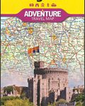 United Kingdom NGS Adventure Map 3325
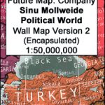 Future Mapping Co. Sinu-Mollweide Political World Wall Map V.2: blue/emerald/pink/yellow ENCAPSULATED
 Future Mapping Co. Sinu-Mollweide Political World Wall Map V.1: gold/aqua/apple/khaki ENCAPSULATED
 Future Mapping Co. Sinu-Mollweide Political World Wall Map V.2: blue/emerald/pink/yellow PAPER
 World Global Mapping Political Wall Map X-LARGE PAPER
 Bedrock Geology of the United Kingdom and Ireland Wall Map
 United Kingdom North BGS Bedrock Geology Map
United Kingdom South Bedrock Geology BGS Wall Map
United Kingdom North BGS Bedrock Geology Map
United Kingdom South Bedrock Geology BGS Wall Map
 World Global Mapping Political Map A3
United Kingdom North BGS Bedrock Geology Pack
World Global Mapping Political Map A3
United Kingdom North BGS Bedrock Geology Pack
 Great Britain & Ireland Michelin Wall Map PAPER
 USA: The Essential Geography of the United States of America Wall Map PAPER
 Environmental World Global Mapping Wall Map PAPER
 World Global Mapping Physical Wall Map LARGE ENCAPSULATED
 Great Britain & Ireland Michelin Wall Map ENCAPSULATED
 Dynamic World Global Mapping Wall Map ENCAPSULATED
 World Global Mapping Physical Wall Map LARGE PAPER
 USA: The Essential Geography of the United States of America Wall Map ENCAPSULATED
 World Global Mapping Physical Wall Map MEDIUM PAPER