Disclosure : This site contains affiliate links to products. We may receive a commission for purchases made through these links.
Categories
-
Best Sellers
-
Limburg South – Sittard – Maastricht – Kerkrade ANWB Cycling Map 40
-

NOAA Chart 11309 – Corpus Christi Bay
NOAA maintains the nautical charts and publications for U.S. coasts and the Great Lakes. Over a thousand charts cover 95,000 miles of shoreline and 3.4 million Read More » -

Sun Valley ID Trail Map
A waterproof, topographic (lat/long,UTM grids) map that includes covers trails throughout Ketchum, Hailey, the Smoky, Boulder and Pioneer Mountains and the Sawtooth Recreation Area. It includes Read More » -
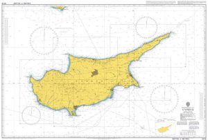
Admiralty Chart 2074 – Cyprus
Admiralty standard nautical charts comply with Safety of Life at Sea (SOLAS) regulations and are ideal for professional, commercial and recreational use. Charts within the series Read More » -

Fumel – Monflanquin IGN 1938SB
Topographic survey of France at 1:25,000 in IGN`s excellent TOP25 / Sรฉrie Bleue series. All the maps are GPS compatible, with a 1km UTM grid plus Read More » -

The Complete Asian Cookbook – Japan and Korea
The Complete Asian Cookbook Series is based on Charmaine Solomon`s groundbreaking work into the delicious and diverse cuisines across many nations. Heralded as a classic when Read More » -

Cargo record book for ships carrying noxious liquid substances in bulk: Cargo/Ballast Operations
-

Atlas of Stateless Nations in Europe
This unique atlas takes us on a tour of the stateless nations in Europe today. It maps their physical and linguistic character, and graphically summarises their Read More » -
Medium Scale Geology Maps
-

Cumberland 1884
Surrey in a series of cloth-backed reproductions from the Old Folding Maps of county maps published in late 19th century by Letts, Son & Co, with Read More »
-


