Disclosure : This site contains affiliate links to products. We may receive a commission for purchases made through these links.
Uganda ITMB
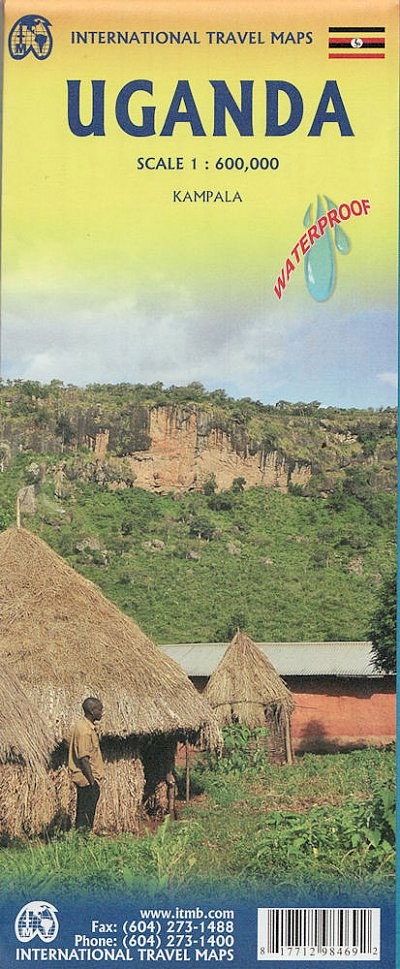
Uganda at 1:600,000 on an indexed, double-sided waterproof map from ITMB, with a street plan of central Kampala annotated with numerous facilities, plus notes on the country’s history, geography, national parks, etc.The map is double-sided, dividing the country north/south with a good overlap between the sides. Topography is shown by altitude colouring in feet, with spot heights also in feet except for main peaks where the height is shown either in metres or both in metres and feet. Graphics indicate wetlands and swamps. National parks are prominently highlighted.Road network distinguishes between paved and unpaved primary roads, indicates seasonal routes and shows selected tracks and trails. Locations of petrol stations and border crossings are marked. Railway lines are included, on lakes ferry connections are shown, and local aerodromes are marked. A range of symbols indicate various places of interest including campsites, rest houses/hostels, UNESCO World Heritage sites, etc. Latitude and longitude lines are drawn at 1ยฐ intervals. Each side has a separate index.The map has a good size, clear street plan of central Kampala showing locations of various hotels, restaurants, bus and rail terminals, and various services or facilities.

Related Products:
 Kenya ITMB
 Belarus ITMB
 Madagascar ITMB
 Jordan & Syria ITMB
 Ethiopia & Eritrea ITMB
 Ghana ITMB
 Accra & Ghana South ITMB
 Namibia ITMB
 Kenya – Tanzania – Uganda F&B
 Angola ITMB
 Saudi Arabia & Kuwait ITMB
 Pakistan ITMB
 Japan North & Hokkaido ITMB
 Tanzania ITMB
 Panama ITMB
 Australia ITMB
 Brazil ITMB
 Cuba ITMB
 Morocco ITMB
 Middle East ITMB Travel Atlas
 Brazil HARDCOVER ITMB
 Mongolia ITMB
 India ITMB
 South America ITMB
 Auckland & North Island ITMB
 Greece ITMB
 Alberta ITMB
 Rocky Mountains Canada and US ITMB
 Belize & Eastern Guatemala ITMB
 Finland ITMB
 Mali ITMB
 Argentina South & Tierra del Fuego ITMB
 Sao Paulo & Brazil South Coast ITMB
 China West ITMB
 Armenia & Azerbaijan ITMB
 Malawi & Mozambique ITMB
 Romania & Moldova ITMB
 Nigeria & Niger ITMB
 Paraguay – Bolivia South ITMB