Disclosure : This site contains affiliate links to products. We may receive a commission for purchases made through these links.
Tyneside and Wearside 1878
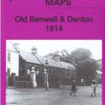
Tyneside and Wearside in 1878 in a series of reproductions of Ordnance Survey’s famous “Inch to the Mile” maps published in the Alan Godfrey Editions to provide a historical record of England and Wales in the second half of 19th and early 20th century.The map is double-sided. Sheet 20 is on one side and covers the area from Corbridge eastward to Newcastle, and southward to Consett; on the reverse sheet 21 covers the area onward to Sunderland, Seaham and the coast. Each map has a brief introduction. Other locations covered by this title includ: in Co. DURHAM Annfield Plain, Bishopwearmouth, Blaydon, Boldon, Burnopfield, Chester-le-Street, Dalton-le-Dale, Dipton, Ebchester, Gateshead, Hebburn, Herrington, Houghton le Spring, Jarrow, Leadgate, Monkwearmouth, Pelton, Ryton, South Shields, Stanley, Tanfield, Washington, Whickham, Whitburn and Winlaton; plus in NORTHUMBERLAND Bywell, Edmondbyers, Heddon on the Wall, Newburn, Ovingham, Prudhoe, Shotleyfield, Throckley, Walbottle, Walker, Wallsend and Wylam.About the Alan Godfrey Editions of the OS Inch to the Mile Maps: the maps provide an invaluable overview of a wider area, typically 18 x 12 miles (29 x 19 kms approx.), and offer historical mapping for small towns and villages not covered by the more detailed series for which the Godfrey Editions are better known. On the reverse all the maps have historical notes and most titles also include a more detailed, large scale map of a small town or a village in the area.To see other titles in this series please click on the series link.

Related Products:
 North Kent Coast 1878
Selsey Bill, Bognor and Worthing 1901
Isles of Scilly 1896
Redesdale 1866
Isle of Thanet 1893 – 274
Kielder 1866
The Cheviot 1901-13 – 5
Ravenglass and Sellafield 1875
North Kent Coast 1878
Selsey Bill, Bognor and Worthing 1901
Isles of Scilly 1896
Redesdale 1866
Isle of Thanet 1893 – 274
Kielder 1866
The Cheviot 1901-13 – 5
Ravenglass and Sellafield 1875
 Great Britain: Godfrey Editions of Historical Ordnance Survey Inch to a Mile Maps of England & Wales
Penzance and St Ives Bay 1888
Dartmoor 1908
Hertford and St Albans 1898
Winchelsea, Hastings and Dungeness 1903
Beachy Head, Newhaven and Eastbourne 1880 – 1903
Formby, Crosby and District 1896
Foulness and Mersea 1904
The Solent 1888
Norham & Berwick 1864 – 1
Tunbridge Wells and Ashdown Forest 1894
Plymouth to Polperro 1894
Kirkby Lonsdale and District 1870
Rothbury Forest 1866-1873
Sevenoaks and Tonbridge 1893
Longtown, Bewcastle and District 1902
North Dartmoor and Mid-Devon 1887
Flodden Field & North Cheviots 1901 – 3
Weston-super-Mare & Highbridge 1897 – 279
South Dartmoor and the South Hams 1909
Holy Island & District 1863 – 4
Garstang and District 1896
Great Britain: Godfrey Editions of Historical Ordnance Survey Inch to a Mile Maps of England & Wales
Penzance and St Ives Bay 1888
Dartmoor 1908
Hertford and St Albans 1898
Winchelsea, Hastings and Dungeness 1903
Beachy Head, Newhaven and Eastbourne 1880 – 1903
Formby, Crosby and District 1896
Foulness and Mersea 1904
The Solent 1888
Norham & Berwick 1864 – 1
Tunbridge Wells and Ashdown Forest 1894
Plymouth to Polperro 1894
Kirkby Lonsdale and District 1870
Rothbury Forest 1866-1873
Sevenoaks and Tonbridge 1893
Longtown, Bewcastle and District 1902
North Dartmoor and Mid-Devon 1887
Flodden Field & North Cheviots 1901 – 3
Weston-super-Mare & Highbridge 1897 – 279
South Dartmoor and the South Hams 1909
Holy Island & District 1863 – 4
Garstang and District 1896
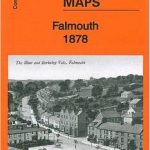 Falmouth 1878
Upper Exe Valley 1907
Poole Harbour and Bournemouth 1893
Falmouth 1878
Upper Exe Valley 1907
Poole Harbour and Bournemouth 1893
 Orford Ness and Felixstowe 1905
Holy Island & Seahouses 1898 – 4.1 Coloured Edition
Fareham, Hambledon and Havant 1894
Southampton Water 1884
Lancaster and District 1896
Cambridge, Newmarket and District 1905
Montgomery and District 1908
Orford Ness and Felixstowe 1905
Holy Island & Seahouses 1898 – 4.1 Coloured Edition
Fareham, Hambledon and Havant 1894
Southampton Water 1884
Lancaster and District 1896
Cambridge, Newmarket and District 1905
Montgomery and District 1908