Disclosure : This site contains affiliate links to products. We may receive a commission for purchases made through these links.
Turkey Central – Cappadocia ITMB
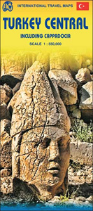
Central Turkey on an indexed, double-sided map at 1:550,000 from ITMB showing road and rail networks on a base with altitude colouring presenting the region’s topography. The map covers the country between its Black Sea and Mediterranean coasts, extending from Ankara and Konya in the west, across Cappadocia, to Malatya and Adiyaman.Road network includes selected country tracks and shows distances on main routes. Symbols highlight various facilities and places of interest. The map has latitude and longitude lines at 30’ intervals. Each side has a separate index.

Related Products:
 Quito & Central Ecuador ITMB
 Central America ITMB
 Turkey ITMB
 Namibia ITMB
 Istanbul & Northwest Turkey ITMB
 Belarus ITMB
 Pakistan ITMB
 Mexico Central & Mexico City ITMB
 Malta & Gozo ITMB
Brazil ITMB
Malta & Gozo ITMB
Brazil ITMB
 Angola ITMB
 Mauritius & Reunion ITMB
 Albania ITMB
 Romania & Moldova ITMB
 Easter Island & Santiago ITMB
 Tel Aviv-Jaffa & Central Israel ITMB
 Cuba ITMB
 Middle East ITMB Travel Atlas
 Morocco ITMB
 Argentina North & Uruguay ITMB
 Brazil HARDCOVER ITMB
 Rwanda & Burundi ITMB
 Central Crete Terrain Editions 449
 Algeria ITMB
 Ethiopia & Eritrea ITMB
 Japan West & Central Railway & Road ITMB
 Madagascar ITMB
 Colombia ITMB
 Central Asia ITMB
 Havana & Cuba Central ITMB
 Lima & Central Peru ITMB
Zambia & Eastern Africa ITMB Road Map
Lima & Central Peru ITMB
Zambia & Eastern Africa ITMB Road Map
 Marrakesh & Northern Morocco ITMB
 Turkey Michelin
 Peru ITMB
 Kenya ITMB
 Argentina South & Tierra del Fuego ITMB
 South Africa – Lesotho – Swaziland ITMB