Disclosure : This site contains affiliate links to products. We may receive a commission for purchases made through these links.
Tumlingtar to Lukla
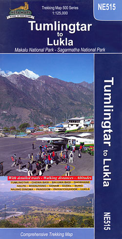
Tumlingtar to Lukla map at 1:125,000 in the Nepa Maps series which provides extensive coverage of trekking areas of Nepal on detailed contoured maps with trekking routes, huts and camp sites, local places of interest and other tourist information.The map covers the region along the Dudh Koshi from the Tibet border, Mount Everest, Lhotse and Makalu southwards to Halesi Marakita, westwards to Salleri and eastwards just beyond Tumlingtar. The main highlighted trail runs from Tumlingtar to Lukla and Namche Bazar, and then north-east to Tengboche, Dingboche, Amphu Labsta Base Camp, and across the Makalu Barun National Park to Shershong and Num. Also marked are numerous other trekking routes in this region. Contours are at 40m intervals, with relief shading and vegetation colouring. Margin ticks show latitude and longitude at intervals of 5’. Index lists places, base camps, peaks, lakes and passes. Titles in this series have cartography is based on the country’s topographic survey, with contours usually at 40m or 50m intervals, enhanced by relief shading, colouring and graphics to show various features of the terrain, including glaciers, forested or cultivated areas, etc. Numerous peaks, with additional spot heights, plus names of glaciers and mountain ranges are prominently shown. The network of rivers, streams and lakes is shown in great detail, with many smaller rivers and lakes named. Overprint highlights main trekking routes and numerous local trails, with symbols indicating various places of interest and tourist facilities. Most maps are indexed and include additional information such as route profiles, glossaries, etc. All the information is in English and heights are given in metres.

Related Products:
 Lukla to Tengboche
 Lukla to Gokyo – Cho-La – Renjo-La – Nagpa-La
 Makalu Base Camp
 Mera Peak
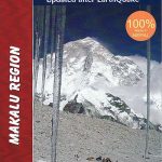 Makalu Region Great Himalay Trail Map
 Everest: Jiri to Everest Base Camp
 Monastry Circuit Trail
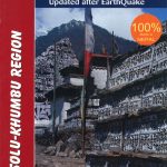 Solu Khumbu – Everest Region Great Himayala Trail Map
 Kanchenjunga
 Island Peak (Imja Tse)
 Dhaulagiri Circuit
 North Annapurna Base Camp
 Helambu Trail
 Khumbu – Sagarmatha National Park
 Cho Oyu
 Mustang to Annapurna
 Numbur Cheese Circuit
 Bhairab Kund
 Annapurna Base Camp
 Naar – Phu
 Gosainkunda – Trek to Shiva`s Sacred Lake
 Panch Pokhari
 Everest Base Camp & Gokyo – Three Passes 50K
 Tenzing-Hillary Trek – Jiri to Everest Base Camp
 Lukla – Salleri
 Pokhara to Muktinath and Jomosom
 Everest – Gokyo – Cho La – the Renjo Pass (60K)
 Upper Mustang
 Upper & Lower Mustang
 Mustang Upper and Lower
 Naya Kanga
 Tatopani Trek
 Tilicho Hidden Lake
 Upper & Lower Dolpo
 Ghorepani – Ghandruk
 Pokhara Valley
 Langtang – Tamang Heritage Trail – Gosainkunda – Helambu 50K
Nepal: Nepa Trekking and Hiking Maps
Langtang – Tamang Heritage Trail – Gosainkunda – Helambu 50K
Nepal: Nepa Trekking and Hiking Maps
 Manaslu & Tsum Valley
 Dudhkunda- Pikey Cultural Trail & Rejno Pass Trail (Jiri – Pikey – Everest)