Disclosure : This site contains affiliate links to products. We may receive a commission for purchases made through these links.
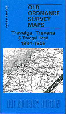
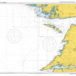
Trevalga – Trevena & Tintagel Head 1894-1908 – 322

Related Products:
 Newquay & Trevose Head 1894 – 335/346
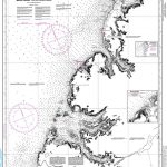
 Admiralty Chart SC5610_9 – Millport to Farland Head and Garroch Head
Tintagel 1905
Admiralty Chart SC5610_9 – Millport to Farland Head and Garroch Head
Tintagel 1905
 Bude, Boscastle & Tintagel OS Explorer Map 111 (paper)
 Bude, Boscastle & Tintagel OS Explorer Active Map 111 (waterproof)
 Admiralty Chart 1840 – Bantry Bay, Black Ball Head to Shot Head
 Admiralty Chart SC5608_6 – Ilfracombe to Worms Head and Mumbles Head
 Admiralty Chart 2699 – Horn Head to Fanad Head with Mulroy Bay
 Admiralty Chart SC5614_21 – Spurn Head to Flamborough Head
 Admiralty Chart SC5622_14 – Morris Head to Old Head of Kinsale
 Admiralty Chart SC5623_10 – Mizen Head and Three Castle Head
 Admiralty Chart 2173 – Loop Head to Slyne Head
 Admiralty Chart 1765 – Old Head of Kinsale to Power Head
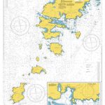 Admiralty Chart 2769 – Barra Head to Greian Head
 CHS Chart 5058 – North Head to Murphy Head
 Admiralty Chart 2092 – Toe Head to Old Head of Kinsale
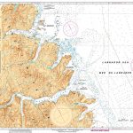
 CHS Chart 4661 – Bear Head to Cow Head
 Instructional Chart 5131 – Saint Govan`s Head to Saint David`s Head
 Admiralty Chart 1478 – Saint Govan`s Head to Saint David`s Head
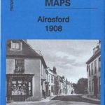 Alresford 1908 – 42.06
 Romsey 1908 – 56.04
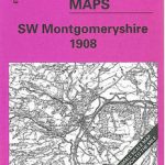 SW Montgomeryshire 1908 – 164
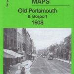 Old Portsmouth & Gosport 1908 – 83.11b
 Eastleigh (South) 1908 – 57.12a
 The Dark Peak 1908-13 – 86
 The Black Mountains 1908 – 214
 North Breconshire 1908 – 196
 Cromer & District 1908 – 131
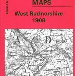 West Radnorshire 1908 – 179
 Fakenham & District 1908 – 146
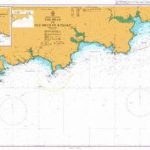
 Eddystone & Salcombe 1908 – 354
 Ammanford & District 1908 – 230
 Merthyr & District 1908 – 231
 South Herefordshire 1908 – 215
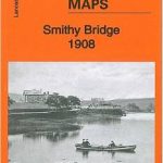 Smithy Bridge 1908 – 81.14
 Eastleigh (North) & Bishopstoke 1908 – 57.08a
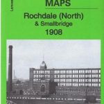 Rochdale (North) & Smallbridge 1908 – 81.13
 Dearne Valley & Barnsley 1908-13 – 87
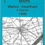 Watton – Swaffham & District 1908 – 160
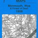 Monmouth – Wye & Forest of Dean 1908 – 233