Disclosure : This site contains affiliate links to products. We may receive a commission for purchases made through these links.
Transylvania
Transylvania on an indexed road map at 1:500,000 from the Hungarian publishers Cartographia. The map provides slightly wider coverage than found on other maps of this region, extending south to include the Iron Gate gorges along the Danube and Bucharest. Relief shading with plenty of names of peaks and mountain ranges gives a good representation of the topography. National parks and protected areas are marked. Road network shows many local roads and prominently indicates scenic routes. Railway lines are included. Symbols mark various places of interest and sites worth visiting, including campsites, spas, etc.Towns and villages have both their Romanian and the old, pre-1920 Hungarian names. Latitude and longitude grid is at 30’ intervals. The index is on the reverse, listing both the current and the historical versions. Map legend includes English.

Related Products:
 Transylvania F&B
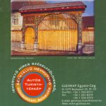 Transylvania South-Eastern Gizi Map
 Italy North K+F Road Map
 Italy K+F Double-Sided Road Map
 Czech Republic
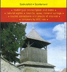 Secuimea Szekelyfold Cartographia Road Map
 Algeria ITMB
 Transylvania terraQuest Adventure Map
 Europe AA Route Planner
 Slovakia
 Germany K+F Road Map
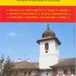
 Transylvania Bradt Guide
 Germany South K+F Road Map
 Ireland Hallwag Road Map
 Bulgaria Cartographia Road Map
 Romania Cartographia Road Map
 Borzsony Cartographia Tourist Map 5
 Bรผkk Cartographia Tourist Map 29
 Vรฉrtes Cartographia Tourist Map 20
 Romania – Moldova Reise Know-How
 Mรกtra Cartographia Tourist Map 14
 Szigetkoz – Tokoz – Czilizkoz
 Zselic Cartographia Tourist Map 17
 Gerecse Cartographia Tourist Map 10
 Koszeg Hills Cartographia Tourist Map 13
 Cserhat – Karancs – Medves Cartographia Tourist Map 8
 Libya Gizi Road Map
Gemenc – Szekszard-Hills Tourist Map
Libya Gizi Road Map
Gemenc – Szekszard-Hills Tourist Map
 Buda Hills Cartographia Tourist Map 6
 Iran Gizi Map
 Zemplen Hills North Cartographia Tourist Map 22
Pilis – Visegrad Hills Cartographia Tourist Map 16
Zemplen Hills North Cartographia Tourist Map 22
Pilis – Visegrad Hills Cartographia Tourist Map 16
 Albania F&B
 Jerusalem & Holy Land ITMB
 Orsรฉg – Gรถcsej – Kemeneshat Cartographia Tourist Map 21
 Central Silesia Hรถfer Road Map
 Mecsek – Villรกny Mountains Cartographia Tourist Map 15
 Danube Bend Cartographia Tourist Map 31
 El Hierro F&B
 Tel Aviv-Jaffa & Central Israel ITMB