Disclosure : This site contains affiliate links to products. We may receive a commission for purchases made through these links.
Transfagaras Road and Tourist Map
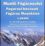
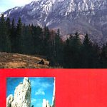
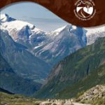
Transfagaras Road, Romania’s most spectacular mountain road across the Fagaras Mountains, on a detailed road map from Bel Alpin showing the whole route at 1:75,000, with its winding central section at 1:30,000, plus extensive English language notes including 15 hiking routes.The map presents the whole traverse of the Fagaras Mountains, opened completely only from June to September, at 1:75,000 with its central section, full of hairpin bends, shown in greater detail at 1:30,000. Both maps are contoured, with spot heights plus colouring and/or graphics for the rocky areas and forests. Connecting roads and paths are marked and symbols highlight locations of mountain refuges, chalets, hunting and forestry lodges, plus mountain rescue posts. The map has no geographical coordinates. Map legend includes English.Both maps show waymarked hiking routes, with the 1:30,000 enlargement highlighting 15 special trails for which descriptions are provided on the reverse side. The notes, in English, also provide a description of the area and its best sights, plus contact details for various types of accommodation.

Related Products:
 Fagaras Mountains Dimap Hiking Map
 Fagaras Mountains Hiking Map and Guide
 Central Italy TCI 400K Road and Tourist Map
 Retezat Mountains Bel Alpin Tourist Map
 Czech Republic 100K Tourist Road Atlas
 Southern Italy – Sardinia – Sicily TCI 400K Road and Tourist Map
 Sudetes Central ExpressMap Tourist Map
 Catalonia Tourist Road – Regional Divisions Map
 Tatra Mountains ExpressMap Tourist Map
 Ljubljana and Environs Kartografija Tourist Map
 Northern Italy TCI 400K Road and Tourist Map
 Posavsko Hribovje Kartografija Tourist Map
 Primorska Kartografija Tourist Map
 Tatra Tourist Attractions (Dookola Tatr)
 Stajerska – Slovene Hills – Haloze – Boc Kartografija Tourist Map
 Julian Alps West Kartografija Tourist Map
 Fagaras – Bucegi – Piatra Craiului terraQuest Trekking Map
 Notranjski Kras – Brkini – Dolenjska – Bela Krajina Kartografija Tourist Map
Western Tatra Mountains Polish and Slovak ExpressMap Tourist Map
Notranjski Kras – Brkini – Dolenjska – Bela Krajina Kartografija Tourist Map
Western Tatra Mountains Polish and Slovak ExpressMap Tourist Map
 Central Europe F&B Compact Road Atlas
 Gurghiu Mountains Northern and Central Dimap Hiking Map
 Central Europe F&B Road Atlas
 High and Bielskie Tatra Mountains – Polish and Slovak ExpressMap Tourist Map
 Parang Mountains Dimap Hiking Map
 Dolomites Tabacco UNESCO Tourist Map
Mexico Road and Tourist Atlas
Dolomites Tabacco UNESCO Tourist Map
Mexico Road and Tourist Atlas
 Swietokrzyskie Mountains ExpressMap Tourist Map
 Piatra Craiului Mountains
 Arequipa Tourist Plan
 Greece: Attika and Central Greece Road Atlas
 Finland South Karttakeskus Outdoor Road Map
 Sweden F&B Road Atlas
 Western Australia Hema Road & 4WD Track Atlas A4 SPIRAL-BOUND
 Old Strynefjellsvegen Nordeca Tourist Route 20009
Roztocze Central ExpressMap Tourist Map
Old Strynefjellsvegen Nordeca Tourist Route 20009
Roztocze Central ExpressMap Tourist Map
 Atlantic Road Nordeca Tourist Route 20012
Sudetes West ExpressMap Tourist Map
Atlantic Road Nordeca Tourist Route 20012
Sudetes West ExpressMap Tourist Map
 Mecsek – Villรกny Mountains Cartographia Tourist Map 15
Gilau Mountains Dimap Hiking Map
Mecsek – Villรกny Mountains Cartographia Tourist Map 15
Gilau Mountains Dimap Hiking Map
 Finland West Karttakeskus Outdoor Road Map