Disclosure : This site contains affiliate links to products. We may receive a commission for purchases made through these links.
Trans-Alpine Crossing – Tegernsee – Achensee – Zillertal – Sterzing Kompass 2556
The 184km long Transalpine Route from the German Alps across the Austrian Tyrol to the Dolomites on a waterproof and tear-resistant, contoured and GPS compatible concertina map from Kompass presenting the route on 13 panels, each 17.5x20cm, plus accommodations recommendations and street plans. Leading from Gmund on lake Tegernsee in Bavaria, the route winds its way across Tyrol via Achensee, Jenbach, Mayrhofen and the Zillertal valley, before crossing to Vipiteno/Sterzing in the Italian South Tyrol.The route is highlighted on maps at 1:50,000 and is annotated with 5km markers. Topography is shown by contours at 40m intervals, enhanced by relief shading and spot heights, with colouring and/or graphics to indicate scree, woodlands, vineyards and hop fields, etc. Symbols show various accommodation options including campsites and youth hostels, sport and recreational facilities, and places of interest. Road network, presented in detail including forest tracks and country paths, indicates locations of car parks. Railway lines and mountain transport facilities (cable car lines, chair lifts) are also marked. Each panel has a 2-km UTM grid. Street plans cover Tegernsee, Achenkirch, Mayrhofen and Vipiteno/Sterzing. A route profile shows the changes in altitude along the trail. Also provided is a list of recommended accommodation facilities for the whole course of the route, plus a list of ‘Mittagseinkehrmรถglichkeiten’ (lunch refreshments possibilities).Map legend includes English; all other text is in German only.

Related Products:
 Vipiteno / Sterzing and Environs Kompass 058
 Vipiteno / Sterzing Kompass 44
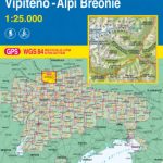 Vipiteno / Sterzing – Alpi Breonie / Stubaier Alpen Tabacco 038
 Vorderes Zillertal – Achensee – Alpbachtal – Wildschonau Kompass 28
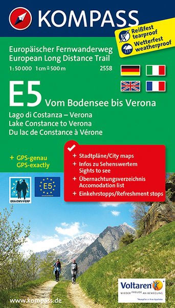
 Lake Constance to Verona – E5 European Long-Distance Trail Kompass 2558
 Germany and Alpine Regions of Europe: Kompass Maps of Long-distance Footpaths
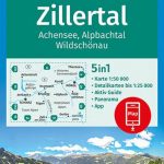
 Mayrhofen – Zillertal Alps – Gerlos – Krimml – Tuxertal – Zell im Zillertal F&B WK152
 Tegernsee – Schliersee – Wendelstein Kompass 8
Tegernsee Valley Kompass 08
Tegernsee – Schliersee – Wendelstein Kompass 8
Tegernsee Valley Kompass 08
 Zillertal – Mayrhofen – Hintertux – Gerlospass K+F Outdoor Map 9
 Tongariro Alpine Crossing
 Mangfallgebirge – Rosenheim – Bayrischzell – Inntal – Tegernsee – Schliersee UK50-53
 South Tyrol Cycling Map
 Zillertal Alps: Trekking and Peaks in the Austrian Tyrol and Italian South Tyrol
 Tegernsee – Schliersee K+F Outdoor Map 5
 Mangfallgebirge West – Tegernsee – Hirschberg Alpenverein BY13
 Zillertal Alps Central – Mayrhofen Alpenverein Map 35/2
 Achensee Kompass 027
 Tyrol Mountain Bike Trail (1000km) Bikeline Atlas
 Zillertal – Tuxer Alps – Jenbach – Schwaz F&B WK151
 Tux Alps – Inntal – Wipptal – Zillertal Kompass 34
Zillertal Alps – Tux Alps Kompass 37
Tux Alps – Inntal – Wipptal – Zillertal Kompass 34
Zillertal Alps – Tux Alps Kompass 37
 South Tyrol Cycle Region Bikeline Map-Guide
 Tongariro Northern Circuit and Tongariro Alpine Crossing
 Rheinsteig long-distance Trail Kompass 2503
 South Tyrol Kompass Hiking & Recreational Kompass Ring-binder Atlas No. 2703: Bormio – Merano – Bolzano – Cortina d`Ampezzo
 Achensee – Rofan – Unterinntal F&B WK321
 Eifelsteig long-distance Trail Kompass 2502
 Southern Black Forest Cycle Tour (240km) Bikeline Map/Guide
Hermannsweg und Eggeweg – die Hermannshohen Kompass Long-distance Trail Map 2504
Southern Black Forest Cycle Tour (240km) Bikeline Map/Guide
Hermannsweg und Eggeweg – die Hermannshohen Kompass Long-distance Trail Map 2504
 Via Bavarica Tyrolensis Cycle Route: Munich to Jenbach (280km) Bikeline Map/Guide
Tegernsee – Schliersee – Wendelstein – Bad Tolz – Miesbach Publicpress Cycling and Hiking 1531
Via Bavarica Tyrolensis Cycle Route: Munich to Jenbach (280km) Bikeline Map/Guide
Tegernsee – Schliersee – Wendelstein – Bad Tolz – Miesbach Publicpress Cycling and Hiking 1531
 Mayrhofen – Tuxer Tal – Zillergrund Kompass 037
 Black Forest: Central and Northern Black Forest Cycle Tour (260km) Bikeline Map/Guide
Vorderes Zillertal – Achensee – Alpbachtal – Wildschรถnau Publicpress Cycling and Hiking 1525
Black Forest: Central and Northern Black Forest Cycle Tour (260km) Bikeline Map/Guide
Vorderes Zillertal – Achensee – Alpbachtal – Wildschรถnau Publicpress Cycling and Hiking 1525
 Romantic Road Cycle Route
 Black Forest Rivers Cycling Routes Bikeline Map-Guide
 Alps-Adriatic Cycle Route – Salzburg to Grado Bikeline Map-Guide
Adriabike Bikeline Cycling Guide
Alps-Adriatic Cycle Route – Salzburg to Grado Bikeline Map-Guide
Adriabike Bikeline Cycling Guide
 Alpenwelt Karwendel – Innsbruck – Achensee – Risstal K+F Outdoor Map 8