Disclosure : This site contains affiliate links to products. We may receive a commission for purchases made through these links.
Tour of the Matterhorn / Cervino L`Escursionista Editore Map-Guide
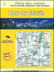
Tour of the Matternhorn (Il Cervino) & Gran Balconata del Cervino long-distance hiking routes presented on a waterproof and tear-restant, double-sided, contoured and GPS compatible map published jointly by L’Escursionista Editore and Editrek, with a separate guide booklet for each route.On one side is a map at 1:50,000 showing the Tour of the Matterhorn (marked TC using the Italian name of the mountain, Il Cervino). Contour interval is 50m, and the map has additional shading and graphic relief to provide a better presentation of the terrain. Symbols indicate campsites, mountain refuges and huts, plus availability of various services. Also marked are bus stops on local roads. The map has a 1-km UTM grid, plus latitude/longitude grid at 5’. Map legend includes English. On the reverse, a similar map at 1:30,000 and with contours at 25m covers the Grande Balconata del Cervino.The title includes two booklets, one for each tour, with multilingual stage-by-stage descriptions (approx. 12 pages in English), plus tables showing availability of local services, contact details for refuges/huts, etc. The Tour of the Matterhorn is described anticlockwise, heading northwards from Randa, then westwards to Zinal and Evolรฉne, southwards to Arolla and across Col de Colon to Italy and Breuil/Cervinia, then across the Theodul Pass back to Switzerland to Zermatt and Randa. The Gran Balconata Route is entirely within Italy and encircles the upper part of Valtourenche from Antey-Saint-Andrรฉ, with a spur south-east to Col Tzecore.For other titles in this series please click on the series link.

Related Products:
 Cervino – Monte Rosa – Valtourenche – Valle di Champorcher L`Escursionista Editore
 Valtournenche – Monte Cervino / Matterhorn – Val d`Ayas West L`Escursionista Editore 7
 Tour of Saint-Bernard L`Escursionista Editore Map-Guide
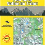 Tour of the Vallรฉe du Trient L`Escursionista Editore Map-Guide
 Tour du Mont Blanc L`Escursionista Editore Map-Guide
 Matterhorn / Cervino – Breuil Cervinia – Champoluc IGC 108
 Matterhorn / M. Cervino – Monte Rosa IGC 5
 Cervino / Matterhorn – Zermatt – Breuil Cervinia Geo4Map 23
 Italy/France/Switzerland: L`Escursionista Editore Maps of High Alpine Tours
 Matterhorn Tour
 Monte Cervino – Valtourneche – Alta Val d’Ayas Fraternali Editore 32
 Gran San Bernardo – Valle di Ollomont L`Escursionista Editore 5
 Valsavarenche – Gran Paradiso L`Escursionista Editore 9
 La Thuile ‘“ Piccolo San Bernardo L`Escursionista Editore 2
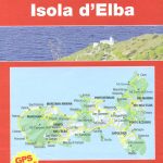 Elba L`Escursionista Editore
 Monte Bianco / Mt Blanc – Courmayeur L`Escursionista Editore 1
 Valle dell`Orco – Gran Paradiso L`Escursionista Editore 14
 Dora Baltea Canavesana – Valchiusella – Valle Sacra L`Escursionista Editore 16
Valpelline – Saint-Barthรฉlemy L`Escursionista Editore 6
Dora Baltea Canavesana – Valchiusella – Valle Sacra L`Escursionista Editore 16
Valpelline – Saint-Barthรฉlemy L`Escursionista Editore 6
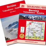 Bernina – Valmalenco – Sondrio L`Escursionista Editore 21
 Valgrisenche – Val di Rhemes – Valsavarenche L`Escursionista Editore 3
 Val di Champorcher – Mont Avic L`Escursionista Editore 11
Basse valli d`Ayas e del Lys L`Escursionista Editore 12
Val di Champorcher – Mont Avic L`Escursionista Editore 11
Basse valli d`Ayas e del Lys L`Escursionista Editore 12
 Val Soana – Valle di Ribordone – Valle di Locana L`Escursionista Editore 15
Alte Valli di Lanzo – Val Grande – Val d`Ala – Val di Viu L`Escursionista Editore 17
Valle di Cogne – Gran Paradiso L`Escursionista Editore 10
Val Soana – Valle di Ribordone – Valle di Locana L`Escursionista Editore 15
Alte Valli di Lanzo – Val Grande – Val d`Ala – Val di Viu L`Escursionista Editore 17
Valle di Cogne – Gran Paradiso L`Escursionista Editore 10
 Monte Rosa – Ayas – Gressoney – Alagna L`Escursionista Editore 8
Italy: L`Escursionista Editore 25K Hiking Maps of the Italian Alps
Monte Rosa – Ayas – Gressoney – Alagna L`Escursionista Editore 8
Italy: L`Escursionista Editore 25K Hiking Maps of the Italian Alps
 La Thuile ‘“ Haute Tarentaise l`Escursionista Editore 01
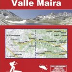 Valle Maira l`Escursionista Editore
 The Matterhorn:The Most Dangerous Mountain
 Trekking the Giants` Trail: Alta Via 1 Through the Italian Pennine Alps: Beneath Mont Blanc, the Matterhorn and Monte Rosa
 Walkers`s Haute Route: Chamonix to Zermatt: The epic journey between Mont Blanc and the Matterhorn
 Ride A Stage of The Tour De France
 The Bernina Tour: 12 Day Tour in Switzerland and Italy and Tour of Italy`s Valmalenco
 Conca di Aosta – Mont Emilius – Mont Fallere L`Escursionista Editore 4
 Valle Centrale – Saint-Barthรฉlemy – Saint-Marcel – Val Clavalite L`Escursionista Editore 13
 Zermatt – Saas-Fee – Matterhorn – Gornergrat – Mittelallalin Swisstopo Hiking 3306T
 Grand Tour of Switzerland Travel Guide
 Matterhorn – Board Game