Disclosure : This site contains affiliate links to products. We may receive a commission for purchases made through these links.
Tottenham 1936 – 13.4
Tottenham in 1936 in a fascinating series of reproductions of old Ordnance Survey plans in the Alan Godfrey Editions, ideal for anyone interested in the history of their neighbourhood or family. Two versions have been published to cover this area of the southern half of Tottenham, stretching from South Tottenham station northward to Bruce Grove station, and from Abbotsford Avenue eastward to the GER railway. Features include Seven Sisters station, West Green station, Tottenham Hale, Page Green, St Ann`s, Tottenham brewery, tramways, The Green, General Hospital, Clyde Circus, Downhills Park and Tottenham High School. The 1936 map shows several industrial sites at Tottenham Hale, including cabinet works, shoe factories and Basildon stationery works.About the Alan Godfrey Editions of the 25″ OS Series:Selected towns in Great Britain and Ireland are covered by maps showing the extent of urban development in the last decades of the 19th and early 20th century. The plans have been taken from the Ordnance Survey mapping and reprinted at about 15 inches to one mile (1:4,340). On the reverse most maps have historical notes and many also include extracts from contemporary directories. Most maps cover about one mile (1.6kms) north/south, one and a half miles (2.4kms) across; adjoining sheets can be combined to provide wider coverage.FOR MORE INFORMATION AND A COMPLETE LIST OF ALL AVAILABLE TITLES PLEASE CLICK ON THE SERIES LINK.

Related Products:
 Tottenham (North) 1936 – 8b
 Walthamstow West 1936 – 14.3
 Tottenham (North) 1894 – 8a
 Kenton and Wealdstone 1936
 Willesden and Stonebridge Park 1936
 Highgate 1936 – 19.4
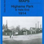 Highams Park and Hale End 1915 – 78.01
Earlestown South 1906
Barnsley 1904
Barnsley 1890 (Colour Edition)
Highams Park and Hale End 1915 – 78.01
Earlestown South 1906
Barnsley 1904
Barnsley 1890 (Colour Edition)
 Honiton 1903
 Mitcham 1910
Wylde Green 1913
Mitcham 1910
Wylde Green 1913
 Leyton 1914
 Lewisham 1914 – 119.3
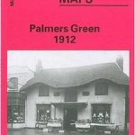 Palmers Green 1912 – 7.14a
Bulwell 1913 – 38.05
Palmers Green 1912 – 7.14a
Bulwell 1913 – 38.05
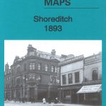 Shoreditch 1893 – 51.2
Trafford Park South 1937
Shoreditch 1893 – 51.2
Trafford Park South 1937
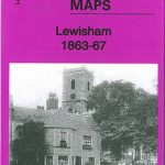 Lewisham 1863-67 – 119.1
Blackrod 1907
Willington Quay 1895
Shoreditch 1872 – 51.1
Lewisham 1863-67 – 119.1
Blackrod 1907
Willington Quay 1895
Shoreditch 1872 – 51.1
 Shoreditch 1914 – 51.3
Rowley Regis and Blackheath 1902
Leyton 1863-1867
Shoreditch 1914 – 51.3
Rowley Regis and Blackheath 1902
Leyton 1863-1867
 Cannock South 1902
Northfield South 1903
Cannock South 1902
Northfield South 1903
 Clydebank 1896
 Altrincham 1908
 Finsbury Park and Stroud Green 1894
 Finsbury Park & Stroud Green 1870 – 20.1
Winson Green and Hockley 1903
Winson Green and Hockley 1888
Leyland 1909
Finsbury Park & Stroud Green 1870 – 20.1
Winson Green and Hockley 1903
Winson Green and Hockley 1888
Leyland 1909
 Finsbury Park & Stroud Green 1912 – 20.3
 Sheffield Hillsborough 1902
 Kidsgrove 1898
Brightlingsea 1895
Brades Village 1902 68.13a
Kidsgrove 1898
Brightlingsea 1895
Brades Village 1902 68.13a