Disclosure : This site contains affiliate links to products. We may receive a commission for purchases made through these links.
Totnes Walking Map 28
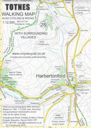
Totnes Walking Map at 1:12,500 from Croydecycle is handy size, double-sided, contoured, printed on light waterproof and tear-resistant synthetic paper and showing National Cycle routes and numerous local facilities, including campsites, pubs, etc.Topography is indicated by contours at 10m intervals, with colouring for different types of vegetation including woodlands with public access. The map also shows the high tide level and classifies beaches as sand, shingle, boulders or rock. Where appropriate, the paths or the terrain are annotated with comments providing useful advice for bikers and hikers. Roads are presented according to the density of traffic and have gradient markings. An overprint indicates cycle paths and private roads with access on bike or foot, as well as bridleways, footpaths and permissive paths. On roads which are part of the National Cycle Network route numbers are marked. Symbols indicate numerous facilities: campsites and caravan sites, pubs and cafes, car parks and picnic sites, local shops, cycle hire, tourist information, etc. National Grid coordinates are marked in the margins.To see other titles in this series please click on the series link.


