Disclosure : This site contains affiliate links to products. We may receive a commission for purchases made through these links.
Toronto & Southern Ontario ITMB
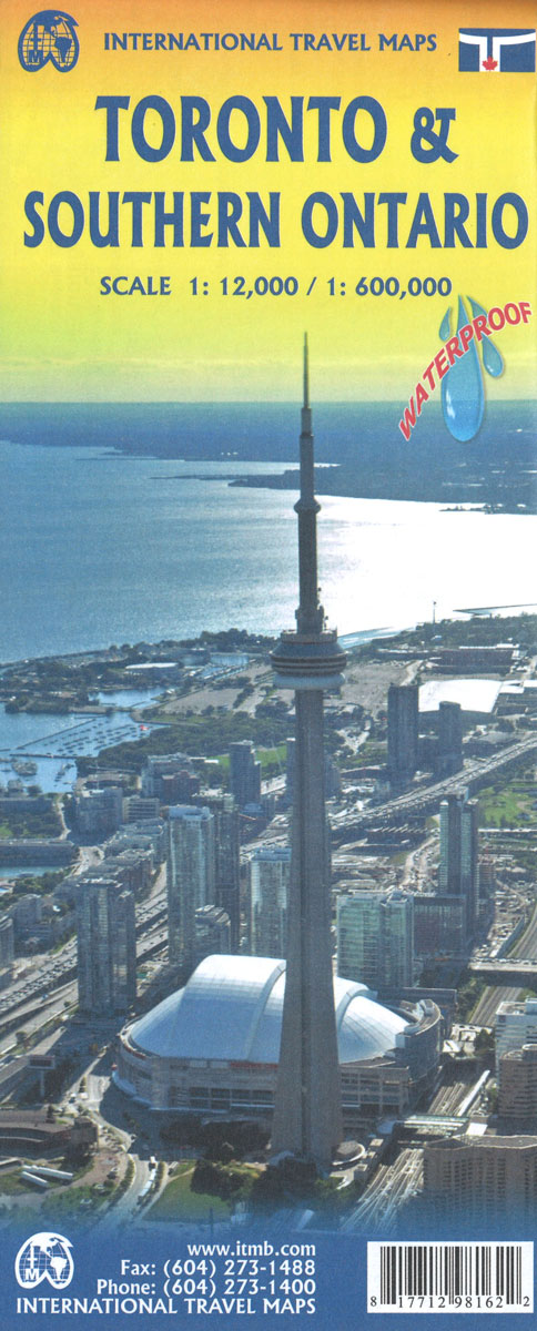
Toronto street plan and a road map of southern Ontario on a double-sided map from ITMB printed on light, waterproof and tear-resistant synthetic paper. On one side is a very clear, indexed street plan of Toronto’s central districts at 1:12,500, providing coverage from the High Park in the west to Riverdale in the east, and inland beyond the Bloor Street. TTC streetcar routes are shown with stops and line numbers; subway and commuter train stations are clearly marked and the whole system is also shown on a separate diagram. For drivers the plan highlights main traffic arteries and indicates one way streets. The map also shows ferry connections within the Inner Harbour and bicycle routes. Symbols mark numerous places of interest, including locations of several hotels. Insets extend the plan to show the beaches area and provide a road map of the Greater Toronto.On the reverse is an indexed road map of the southern part of Ontario at 1:800,000. Centred on Niagara Falls, coverage within Canada extends from Ottawa to Sudbury in the west, and includes the US side of lakes Ontario and Erie.

Related Products:
 Southern Ontario ITMB
 Ontario South Central – Toronto – Niagara Falls – Kitchener-Wateroo Mapart Back Road Map
 Ontario ITMB
 Quebec & Ontario ITMB Travel Atlas
 Ontario MapArt
 Moon Toronto & Ontario: With Niagara Falls, Ottawa & Georgian Bay
 Southern Quebec ITMB
 Ontario MapArt Pocket Road Atlas
 Helsinki & Southern Finland ITMB
 Montreal & Southern Quebec ITMB
 Africa Southern ITMB
 Los Angeles & Southern California ITMB
 Rome & Southern Italy ITMB
 Toronto & Area MapArt Street Atlas
 Ontario Eastern MapArt
 Ontario Northern FastTrack Map: North Bay – Sudbury – Thunder Bay – Lake of the Woods
 Zurich & Switzerland NW ITMB
 Manhattan & New York State ITMB
 Ontario MapArt Back Road Atlas
 Toronto Borch
 Stockholm & Southern Sweden ITMB
 NOAA Chart 14810 – Olcott, New York to Toronto, Ontario (Metric) – Olcott – Wilson Harbor
 Guangzhou & China South ITMB
 Fodor`s Toronto 25 Best
 Jerusalem & Holy Land ITMB
 Algeria ITMB
 Jordan & Syria ITMB
 Toronto MapArt Street Plan
 Tel Aviv-Jaffa & Central Israel ITMB
 Miami & South Florida ITMB
 Bangkok & Thailand South ITMB
 Greece ITMB
 DK Eyewitness Top 10 Toronto 7/5/20
 Quito & Central Ecuador ITMB
 Southern Vietnam – Mekong Delta ITMB
 Accra & Ghana South ITMB
 Chicago & Lake Michigan ITMB
 Chile South & Patagonia ITMB
 Kyoto & Japan West ITMB