Disclosure : This site contains affiliate links to products. We may receive a commission for purchases made through these links.
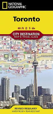
Toronto NGS City Destination Map

Related Products:
 Toronto Crumpled City Map
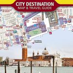 Venice NGS City Destination Map
 Washington DC NGS City Destination Map
 Florence NGS City Destination Map
 San Francisco NGS City Destination Map
 Chicago NGS City Destination Map
 London NGS City Destination Map
 Prague NGS City Destination Map
 Paris NGS City Destination Map
 Buenos Aires NGS City Destination Map
 Wallpaper* City Guide Toronto
 Vancouver NGS City Destination Map
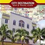 Miami & the Keys NGS City Destination Map
 Concrete Toronto Map: Guide to Concrete and Brutalist Architecture in Toronto
 Toronto Borch
 Toronto Pocket Street Atlas
 Toronto MapArt Street Plan
 Toronto & Southern Ontario ITMB
 Toronto & Area MapArt Street Atlas
 Destination India
 Cascades Destination Map
 Sierra Nevada Destination Map
 Four Corners Region Destination Map
 Canadian Rockies NGS Destination Map
 Pocono Mountains Destination Map
 Ontario South Central – Toronto – Niagara Falls – Kitchener-Wateroo Mapart Back Road Map
 Alaska`s Inside Passage NGS Destination Map
 New York`s Finger Lakes Destination Map
 Texas Hill Country Destination Map
 Wisconsin`s Door Peninsula Destination Map
 Blue Ridge Parkway NC/VA Destination Map
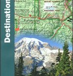
 National Parks of the United States NGS Destination Map
 Toronto Noir
 DK Eyewitness Top 10 Toronto 7/5/20
 Fodor`s Toronto 25 Best
 The Hunt Toronto
 111 Places in Toronto That You Must Not Miss
 The 500 Hidden Secrets of Toronto
 Lonely Planet Pocket Toronto
 Toronto: The Monocle Travel Guides