Disclosure : This site contains affiliate links to products. We may receive a commission for purchases made through these links.
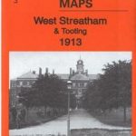
Tooting 1913 – 134.3
Tooting in 1913 in a fascinating series of reproductions of old Ordnance Survey plans in the Alan Godfrey Editions, ideal for anyone interested in the history of their neighbourhood or family. Two versions for this area have been published to show how it developed across the years; coverage is less complete on the 1913 map where the Surrey part of the map is left blank. The 1894 map covers the area from Wimbledon cemetery and Cromwell Road eastward to St Nicholas` church, Mitcham Road and Vant Road, and from Maskell Road and Huntspill Road southward to Cowper Road and Trevelyan Road. Features include Fountain Hospital; Lambeth, Wimbledon and Streatham cemeteries; Tooting Graveney, Merton Road, High Street, Mitcham Road, St Clement Danes Almshouses, tramways along Upper Tooting Road; a stretch of the River Wandle with industries, including Garratt Printing Works; Durnsford Lodge Hospital, Haydon`s Road station. The map has street directory extracts for Bickersteth Road, Blackshaw Road, Broadway, Garratt Lane, Hereward Road, Mellison Road, Merton Road and Mitcham Road. The 1913 map (published by the OS as London Sheet XII.4) has Surrey – the area west of Lambeth Cemetery – left blank. In this version the marginal London sheet XII.8 to the south is provided as an inset for completion. The map excludes Haydons Road station, Wimbledon cemetery and the River Wandle area, but it does cover the massive Grove Hospital, more extensive tramways, and more streets, especially between Backshaw Road and Garratt Lane. Street directories are included for Defoe Road, Garratt Lane, Tooting High Street, Mitcham Road, Selkirk Street and a few others. About the Alan Godfrey Editions of the 25″ OS SeriesSelected towns in Great Britain and Ireland are covered by maps showing the extent of urban development in the last decades of the 19th and early 20th century. The plans have been taken from the Ordnance Survey mapping and reprinted at about 15 inches to one mile (1:4,340). On the reverse most maps have historical notes and many also include extracts from contemporary directories. Most maps cover about one mile (1.6kms) north/south, one and a half miles (2.4kms) across; adjoining sheets can be combined to provide wider coverage.FOR MORE INFORMATION AND A COMPLETE LIST OF ALL AVAILABLE TITLES PLEASE CLICK ON THE SERIES LINK.

Related Products:
 West Streatham & Tooting 1913 – 135b
 Putney 1913 – 113.3
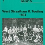 West Streatham & Tooting 1894 – 135a
 Dulwich Village 1913
 Highgate 1913 – 19.3
Camberwell & Stockwell 1913 – 102.3
Highgate 1913 – 19.3
Camberwell & Stockwell 1913 – 102.3
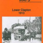 Lower Clapton 1913 – 31.3
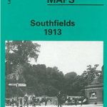 Southfields 1913 – 123.3
 Battersea & Clapham 1913 – 101.3
Hackney 1913 – 41.3
Battersea & Clapham 1913 – 101.3
Hackney 1913 – 41.3
 The Hawthorns 1913
Brixton & Herne Hill 1913 – 116.3
The Hawthorns 1913
Brixton & Herne Hill 1913 – 116.3
 Hammersmith & Fulham 1913 – 86.3
 Wandsworth & SW Battersea 1913 – 114b
 Walsall (NE) 1913 – 63.07
 Clapham Park & Balham 1913 – 125.3
 Muswell Hill 1913 – 11.3
 Putney Bridge & Fulham 1913 – 99.3
 Dalston 1913 – 40.3
Chelsea 1913 – 87.3
Dalston 1913 – 40.3
Chelsea 1913 – 87.3
 Ealing 1913
 Handsworth 1913
Birmingham South 1913
Handsworth 1913
Birmingham South 1913
 Keighley North 1913
Redcar and Coatham 1913
Keighley North 1913
Redcar and Coatham 1913
 East Acton & Wormholt 1913 – 58.3
 Whitechapel, Spitalfields & The Bank 1913 – 63.3
Walthamstow Marshes 1913 – 22.3
Walthamstow West 1913
Pimlico, Sloane Square & Nine Elms 1913 – 88.3
Whitechapel, Spitalfields & The Bank 1913 – 63.3
Walthamstow Marshes 1913 – 22.3
Walthamstow West 1913
Pimlico, Sloane Square & Nine Elms 1913 – 88.3
 Greenwich and the Isle of Dogs 1913
Elswick 1913
Greenwich and the Isle of Dogs 1913
Elswick 1913
 West Norwood 1913 – 136.3
Nottingham NW (New Basford & Hyson Green) 1913 – 38.13
Euston & Regent`s Park 1913 – 49.3
West Norwood 1913 – 136.3
Nottingham NW (New Basford & Hyson Green) 1913 – 38.13
Euston & Regent`s Park 1913 – 49.3
 Birmingham Central 1913
East Jarrow 1913
Byker and Heaton 1913
Bulwell 1913 – 38.05
Halesowen (East) 1913 – 5.13b
Birmingham Central 1913
East Jarrow 1913
Byker and Heaton 1913
Bulwell 1913 – 38.05
Halesowen (East) 1913 – 5.13b