Disclosure : This site contains affiliate links to products. We may receive a commission for purchases made through these links.
Tongariro Alpine Crossing
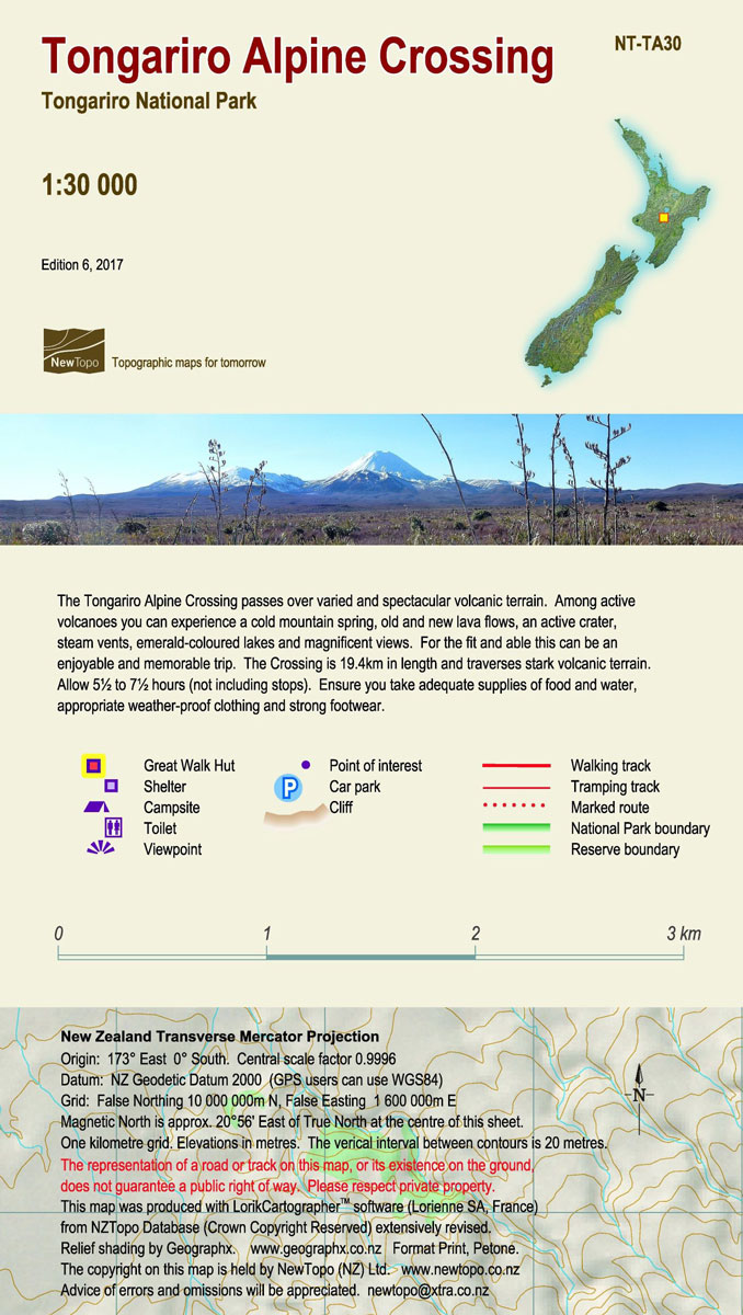
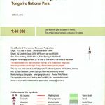
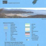
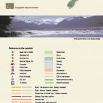
Tongariro Alpine Crossing in the Tongariro National Park at 1:30,000 in a series of contoured and GPS compatible maps from NewTopo NZ Ltd, with exceptionally vivid presentation of the terrain, routes clearly highlighted, and symbols to show locations of various facilities. The route is highlighted – indicating walking, tramping and waymarked section and junctions with the Tongariro Northern Circuit ‘“ and annotated at various points with brief notes. Symbols show campsites, huts, viewpoints, etc. Contour interval is 20m with special graphics for the lava fields.Maps in the series from NewTopo NZ Ltd cover the country’s popular hiking and tramping areas. The maps have contours (20m in most titles – please confirm in the individual description) enhanced by relief shading, plus colouring and/or graphics to indicate various types of the terrain and vegetation: glaciers, scree, lava flows, shingle, sand, swamps, exotic forest, scrub, native bush, etc. The overprint for the routes distinguishes, as appropriate, between tramping tracks and routes, walking tracks, and waymarked or unmarked trails. Symbols show facilities such huts, campsites, public toilets, viewpoints, car parks, etc. Where useful, the maps also have brief notes about hut reservations. All the titles are GPS compatible, most with a 1-km NZ national grid (GPS users can uses WGS84).To see all the titles in this series please click on the series link.

Related Products:
 Tongariro Northern Circuit and Tongariro Alpine Crossing
 Tongariro NP: Ruapehu Round the Mountain Track
 Tongariro NP: Mount Ruapehu
 Coromandel Peninsula
 Aotea / Great Barrier Island
 Aoraki / Mount Cook
 Routeburn, Greenstone and Caples Tracks
 Golden Bay
 Kepler Track
 Milford Track
 Abel Tasman National Park Coast Track and Inland Track NewTopo Walking Map
 Waikaremoana – Te Urewera NewTopo Walking Map
 Mount Taranaki
 Mt Arthur and the Cobb Valley
 Lake Taupo
 Rakiura / Stewart Island – North West Circuit Rakiura NP
 Arthur`s Pass
 Rees-Dart Circuit
 Cape Reinga Coastal Walkway
 Heaphy Track
New Zealand: NewTopo Hiking Maps
Heaphy Track
New Zealand: NewTopo Hiking Maps
 Marlborough Sounds: Queen Charlotte Track
 Marlborough Sounds
 Trans-Alpine Crossing – Tegernsee – Achensee – Zillertal – Sterzing Kompass 2556
 Munich Alpine Foreland Cycling Map
 Grintovci Slovenian Alpine Club 25K Map
 Storzic – Kosuta Slovenian Alpine Club 25K Map
 Jalovec and Mangart Slovenian Alpine Club 25k Map
 Polhograjsko Hribovje Slovenian Alpine Club 25K Map
 Ljubljana and Environs Slovenian Alpine Club 50K Map
 Posavsko Hribovje East: Boc – Bohor Slovenian Alpine Club 50K Map
 Slovenia: Alpine Club 50K and 25K Hiking Maps
Germany and Alpine Regions of Europe: Kompass Maps of Long-distance Footpaths
Slovenia: Alpine Club 50K and 25K Hiking Maps
Germany and Alpine Regions of Europe: Kompass Maps of Long-distance Footpaths
 Alpine Lakes Wilderness – Mt Baker-Snoqualmie and Okanogan-Wenatchee National Forests WA
 Urzulei
 Beskid Maly
 Beskid Zywiecki
 Loiri – Porto San Paolo
 Western Tatras – Polish and Slovak
 Triglav Pocket Map