Disclosure : This site contains affiliate links to products. We may receive a commission for purchases made through these links.
Disclosure : This site contains affiliate links to products. We may receive a commission for purchases made through these links.
Categories
-
Best Sellers
-

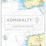
Admiralty Chart SC5608_1 – Hartland Point to Worms Head
NEWAdmiralty Small Craft nautical charts comply with Safety of Life at Sea (SOLAS) regulations and are ideal for professional, commercial and recreational use. Charts within the Read More » -

Little Explorers Under the Sea
UNDER THE SEA is a lively introduction to life beneath the waves, where children can lift the flaps to learn about an under water world. Young Read More » -

We Need New Names
`To play the country-game, we have to choose a country. Everybody wants to be the USA and Britain and Canada and Australia and Switzerland and them. Read More » -

Canoeing – Ray Goodwin
This is a thoroughly modern book on the traditional open canoe. It covers all aspects of the open canoe, from design to wilderness travel. What really Read More » -

Earthshattering Events!: The Science Behind Natural Disasters
We humans take our domination of the planet for granted, but sometimes nature reminds us that this is an illusion. Tectonics rip open the earth, vast Read More » -
Admiralty Routeing Chart 5127(12) – N Pacific – December
Essential for use in passage planning for ocean voyages, Routeing Charts include routes and distances between major ports, ocean currents, ice limits, load lines and wind Read More » -

NOAA Chart 18485 – Cape Flattery
NOAA maintains the nautical charts and publications for U.S. coasts and the Great Lakes. Over a thousand charts cover 95,000 miles of shoreline and 3.4 million Read More » -

Valletta: Heritage Malta
City of VallettaInscribed on UNESCO`s World Heritage List in 1980, Valletta is the capital city of the small island-state of Malta. The foundation stone was laid Read More » -

South Western Bohemia
South Western Bohemia at 1:200,000 from Hรถfer Verlag in a series of road maps of areas which used to be part of Germany or the Austro-Hungarian Read More » -

Penzance 1877 – 74.02 Coloured Edition
-


