Disclosure : This site contains affiliate links to products. We may receive a commission for purchases made through these links.
Tierra del Fuego – Cordillera Darwin – Lago Fagnano – Isla Navarino SIG Patagon
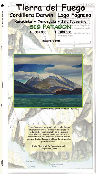
Tierra del Fuego at 1:585,000 on light, waterproof and tear-resistant, GPS-compatible map from SIG Patagon, plus on the reverse Isla Navarino at 1:85,000, with tourist facilities including accommodation and campsites, etc.On one side a map at 1:585,000 covers most of Tierra del Fuego, extending on the Argentinian side eastwards beyond the road liking Rio Grange with Tolhuin. With Punta Arenas on the western edge of the map, coverage also includes the whole of the Isla Dawson. Topography is presented by relief shading, with boundaries of protected areas. The map shows local roads and tracks, and symbols indicate locations with tourist facilities, sites for trekking and watching local fauna, etc. Also marked are ferry connections. The map has a UTM grid, plus latitude and longitude margin ticks at 1ยบ. PLEASE NOTE: most place names on this map are in very small print.On the reverse Isla Navarino with the Beagle Channel and Ushuaia is shown enlarged to 1:85,000, with contour lines at 50m intervals and tourist information clearly visible. The map shows the route of a hiking trail from Puerto Williams southwards to Lago Windhond and iNdicates numerous locations for watching local fauna. This side also has a UTM grid plus margin tick at 30’. Map legends for both sides are in Spanish only. To see other titles in this series please click on the series link.

Related Products:
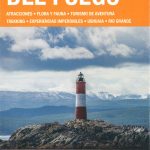
 Tierra del Fuego and Isla Navarino
 Punta Arenas – Peninsula de Brunswick SIG Patagon
 Patagonia & Tierra del Fuego ITMB
 Argentina South & Tierra del Fuego ITMB
 Tierra del Fuego de Dios Map-Guide SPANISH
 Tierra del Fuego – Antarctica
 Southern Patagonia – Tierra del Fuego
 Torres del Paine – Puerto Natales – Sierra Baguales SIG Patagon
 Patagonia And Tierra Del Fuego Nautical Guide – 3rd Edition
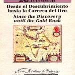 Tierra del Fuego Historical Maps
 Rio Verde – Laguna Blanca SIG Patagon
 Antarctica – Tierra del Fuego ITMB
 Tierra del Fuego – Sector Argentino
 The Lost Tribes of Tierra del Fuego: Selknam, Yamana, Kawesqar
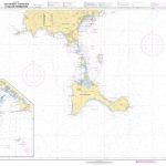
 Admiralty Chart 1373 – South-Eastern Part of Tierra del Fuego
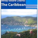 A14 San Juan to Isla de Vieques and Isla de Culebra
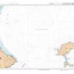
 NGA Chart 21033 – Isla del Cano to Isla la Plata
 NGA Chart 25800 – Isla Beata to Isla Saona
 SHOM Chart 7783 – Isla de Ibiza – Partie Sud et Isla de Formentera
 SEMAR Chart 922 – Isla Mujeres to Isla Cozumel
 SHOM Chart 7669 – De Cabo de la Nao au port de Sagunto Isla de Ibiza et Isla de Formentera
 Huaraz, Peru – Cordillera Blanca & Huayhuash Tourist Map
 Admiralty Chart 662 – Isla de Guanaja to Isla Cozumel including the Gulf of Honduras
 SHOM Chart 7783L – Isla de Ibiza – Partie Sud et Isla de Formentera – Leisure A4 size
 SHOM Chart 7669L – De Cabo de la Nao au port de Sagunto Isla de Ibiza et Isla de Formentera – Leisure A4 size
 Isla Cedros
Isla Cerralvo
Isla San Esteban
Isla Marias
Isla Angel de le Guarda
Isla Cedros
Isla Cerralvo
Isla San Esteban
Isla Marias
Isla Angel de le Guarda
 Isla Redonda CNIG Topographic Map 987-II
Isla Cristina CNIG Topographic Map 998-IV
Isla Redonda CNIG Topographic Map 987-II
Isla Cristina CNIG Topographic Map 998-IV
 Chile: SIG Patagon Exploration and Trekking Maps
 Isla de Alegranza CNIG Topo 1079
 Admiralty Chart 1020 – Punta Morro de Puercos to Isla Del Cano and Isla Del Coco
Lago d`Orta 30K Zanetti Map No. 52
Admiralty Chart 1020 – Punta Morro de Puercos to Isla Del Cano and Isla Del Coco
Lago d`Orta 30K Zanetti Map No. 52
 Lago Maggiore: Cannobio 30K Zanetti Map No. 58
 Monte Fitzroy & Cerro Torre – Lago Desierto
 South-Western Nicaragua – Masaya – Granada
 Lago Maggiore: Golfo Borromeo 30K Zanetti Map No. 53