Disclosure : This site contains affiliate links to products. We may receive a commission for purchases made through these links.
Tien Shan: Lake Issyk-Kul North 100K Goskartografiya Trekking Map

The area between Lake Issyk-Kul and the Kazakhstan border on a contoured and GPS compatible, double-sided topographic map at 1:100,000 from Goskartografiya in Bishkek, with all place names in the Cyrillic alphabet and an English map legend. Coverage extends eastwards from Orlovka, just west of the E125 road linking the lake with Tokmok, to Semenovka on the north-eastern shore of the lake. The map has contours at 40m intervals with numerous spot heights, plus colouring for forests, moraine and glaciers. Road network indicates paved, gravel and dirt roads. An overprint highlights trekking routes, indicating waymarked or not signposted trails. The map has a 2-km UTM grid. Map legend is in English.PLEASE NOTE: deliveries of titles published in Kyrgyzstan are infrequent – no delivery time can be specified for any titles currently out of stock.

Related Products:
 Tien Shan: Lake Issyk-Kul North Trekking Map
 Tien Shan: Bishkek & Kyrgyz Range – Kรผngรถy Ala-Too Range 100K Gostartografiya Trekking Map
 Tian Shan: Karakol – Engilchek Glacier – Jengish Chokusu (Pik Pobedy) – Khan Tengri Goskartografiya Trekking Map
 Inylchek – Tien Shan Alpenverein 0/14
 Internal Tien-Shan Trekking Map
 Khan Tengri – Tien Shan Alpenverein 0/15
 Tian Shan – Khan Tengri – Pobeda Peak – Lenin Peak terraQuest Trekking Map
 Peru: Alpenvereinskarte Trekking Maps
 Georgia: Geoland 50K Trekking Maps
 Lake Asveja and Environs
Moletai Lake District
Lake Asveja and Environs
Moletai Lake District
 Iceland North East: Hรบsavik – Lake Mรฝvatn – Bakkagerรฐi
 Lake Como terraQuest Trekking Map
 Tilicho Hidden Lake
 Dunai to Jumla and Rara Lake
 Iceland North: Hvammstangi – Mรฝvatn Lake
 Tsum Valley Trekking Map
 Lake Maggiore – Lake Orta – Lake Varese K+F Outdoor Map 8
 Aconcagua terraQuest Trekking Map
 Lake Garda terraQuest Trekking Map
 Nepal: Nepa Trekking and Hiking Maps
 Around Annapurna (100K)
 Gosainkunda – Trek to Shiva`s Sacred Lake
 Northern Agrafa – Plastira Lake Anavasi 4.1
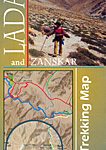 Ladakh and Zanskar Trekking Map
Lake Garda – Lake Idro – Monte Baldo – Verona K+F Outdoor Map 7
Ladakh and Zanskar Trekking Map
Lake Garda – Lake Idro – Monte Baldo – Verona K+F Outdoor Map 7
 Skadar Lake National Park
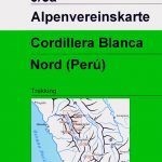 Cordillera Blanca North Alpenverein 0/3A
 Karakoram – K2 – Gasherbrum – Broad Peak terraQuest Trekking Map
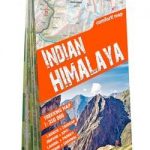 Indian Himalaya terraQuest Trekking Map
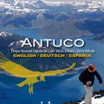 Antuco – Laguna del Laja National Park
 Lake Como – Lake Lugano Kompass 91
 Lake Luzern – Luzern – Rigi – Pilatus
 Lake Balaton Cycling Atlas
 Torres del Paine Trekking Map
 Iceland North East
 Lake Maggiore – Lake Varese Kompass 90
 Iceland North West
 Black Forest – Lake Constance K+F Road Map