Disclosure : This site contains affiliate links to products. We may receive a commission for purchases made through these links.
Tibet – Mount Everest – Nam Tso – Lhasa – Shigatse terraQuest Tourist Map

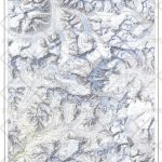
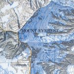
Southern Tibet at 1:400,000 on a laminated, waterproof and tear-resistant map from terraQuest, with contours, relief shading and colouring providing a very vivid picture of the region’s topography. The map, double-sided and arranged in three separate panels, covers an area from Medro Gungkar, east of Lhasa, to the Friendship Bridge crossing to Nepal, west of Mount Everest.Topography is presented by contours, enhanced by relief shading and colouring for glaciers and different types of vegetation, with plenty of names of mountain ranges, peaks and passes. National parks and other protected areas are prominently highlighted. The map shows the region’s road network and the rail link to Lhasa, and also indicates main trekking routes, e.g. treks to the Everest and Cho Oyu Base Camps, the trek south from Ganden to Samye, or the route from Damshung to Nam Tso lake. Interesting locations are highlighted, and the map shows availability of tourist accommodation and various facilities, etc. Latitude and longitude lines are drawn at 5’ intervals. Map legend includes English.The map is laminated in a format similar to the old cloth-dissected maps so that sections of it can be easily folded back without damage.


