Disclosure : This site contains affiliate links to products. We may receive a commission for purchases made through these links.
Tian Shan – Khan Tengri – Pobeda Peak – Lenin Peak terraQuest Trekking Map
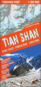
Double-sided, waterproof and tear-resistant, contoured and GPS compatible map from TerraQuest, covering the whole of Kyrgyzstan at 1:1,000,000, with additional panels providing more detailed coverage for trekking at scales between 1:100,000 and 1:125,000 and covering the Karakol region, Ala-Archa, Inylchek area with Jengish Chokusu (Pobeda Peak) and Khan Tengri, plus the Lenin Peak (Peak Achiktash) border area.The map of Kyrgyzstan provides a very good presentation of the country’s geography through satellite-based relief and plenty of names of topographic features. National parks and other protected areas are highlighted. Road network shows distances on main routes. Symbols indicate various facilities and places of interest, including local airports, tourist information offices, etc. Latitude and longitude grid is at 10’ intervals.Multilingual map legend includes English.The map of Kyrgyzstan clearly shows which areas are presented in greater details on enlargements with contours at 50m intervals with numerous spot heights, relief shading, plus colouring for glaciers and forested areas. Trekking routes are marked, indicating more difficult sections and base camps. Symbols show locations with hotels and other tourist accommodation, restaurants and tourist information points. Latitude and longitude grid is at 1’ intervals.The map is laminated in a format similar to the old cloth-dissected maps so that sections of it can be easily folded back without damage.

Related Products:
 Tian Shan: Karakol – Engilchek Glacier – Jengish Chokusu (Pik Pobedy) – Khan Tengri Goskartografiya Trekking Map
 Khan Tengri – Tien Shan Alpenverein 0/15
 Karakoram – K2 – Gasherbrum – Broad Peak terraQuest Trekking Map
 Africa`s Highest Peaks – Kilimanjaro – Mount Kenya – Rwenzori terraQuest Trekking Map
 Georgian Caucasus – Mt Ushba – Shkhara – Kazbek terraQuest Trekking Map
 Tien Shan: Bishkek & Kyrgyz Range – Kรผngรถy Ala-Too Range 100K Gostartografiya Trekking Map
 Turkey`s Highest Peaks – Mount Ararat – Kackar Mountains – Mount Suphan terraQuest Trekking Map
 Aconcagua terraQuest Trekking Map
 Lenin Peak
 Indian Himalaya terraQuest Trekking Map
 Madeira terraQuest Trekking Map
 Mera Peak
 Lake Como terraQuest Trekking Map
 Central Pyrenees terraQuest Trekking Map
Tien Shan: Lake Issyk-Kul North Trekking Map
Central Pyrenees terraQuest Trekking Map
Tien Shan: Lake Issyk-Kul North Trekking Map
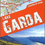 Lake Garda terraQuest Trekking Map
 Tien Shan: Lake Issyk-Kul North 100K Goskartografiya Trekking Map
 Fagaras – Bucegi – Piatra Craiului terraQuest Trekking Map
 Patagonia – Fitz Roy – Cerro Torre – Perito Moreno Glac – Torres del Paine terraQuest Trekking Map
 Paldor Peak
Georgia – Caucasus Mountains terraQuest Adventure Map
Paldor Peak
Georgia – Caucasus Mountains terraQuest Adventure Map
 Cusco Trekking Map
 Peak District – Dark Peak A-Z Adventure Atlas
 Island Peak (Imja Tse)
 Everest Region Trekking Map
 Pisang Peak
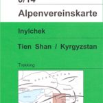 Inylchek – Tien Shan Alpenverein 0/14
 Tibet – Mount Everest – Nam Tso – Lhasa – Shigatse terraQuest Tourist Map
 Torres del Paine Trekking Map
 Tsum Valley Trekking Map
 Bhutan Himalaya Trekking Map
Nepal: Nepa Trekking and Hiking Maps
Bhutan Himalaya Trekking Map
Nepal: Nepa Trekking and Hiking Maps
 Internal Tien-Shan Trekking Map
 Rila – Pirin terraQuest Trekking Map
 Peru: Alpenvereinskarte Trekking Maps
 High Atlas – Jbel – Toubkal terraQuest Trekking Map
 India: Ed. Olizane Trekking Maps of Ladakh and Zanskar
 Aconcagua Climbing and Trekking Map