Disclosure : This site contains affiliate links to products. We may receive a commission for purchases made through these links.
Thusis Swisstopo 1215

Map No. 1215, Thusis, in the topographic survey of Switzerland at 1:25,000 from Bundesamt fรผr Landestopographie (swisstopo), covering the whole country on 247 small format sheets, with special larger maps published for popular regions including some titles now available in hiking versions.Highly regarded for their superb use of graphic relief and hill shading, the maps give an almost 3-D picture of Switzerland`s mountainous terrain. Contours are at 10 m intervals, with 20m intervals in the mountainous areas. All the maps have a 1-km grid for Swiss national coordinates (datum CH 1903). *Small format sheets (Nos. 1011 – 1374)*Map legend in the language of the area covered by the map. Additional margin ticks show latitude and longitude in steps of 2`. The area covered by each map is 17 x 12 km (11 x 7 miles approx). *Special larger sheets (Nos. from 2501 onwards) ‘“ STANDARD editions:* No map legend is included but a separate leaflet can be provided instead. The area covered by each map is 25 x 17 km (15 x 11 miles approx).*Special larger sheets (Nos. from 2501 onwards) ‘“ HIKING editions:* An overprint highlights hiking, mountain and alpine paths, including regional and national long-distance trails. The maps also show bus routes with bus stops, plus inns in remote locations. The area covered by each map is 25 x 17 km (15 x 11 miles approx).

Related Products:
 Gex Swisstopo 1280
Piz Lad Swisstopo 1199bis
Gex Swisstopo 1280
Piz Lad Swisstopo 1199bis
 Wil Swisstopo 1073
Zug Swisstopo 1131
Wil Swisstopo 1073
Zug Swisstopo 1131
 Val de Ruz Swisstopo 1144
Elm Swisstopo 1174
Val de Ruz Swisstopo 1144
Elm Swisstopo 1174
 Bischofszell Swisstopo 1074
 Schรถftland Swisstopo 1109
Stรคfa Swisstopo 1112
Klรถntal Swisstopo 1153
Vรคttis Swisstopo 1175
Schรถftland Swisstopo 1109
Stรคfa Swisstopo 1112
Klรถntal Swisstopo 1153
Vรคttis Swisstopo 1175
 Lรถtschental Swisstopo 1268
 Basรฒdino Swisstopo 1271
 Val-d`Illiez Swisstopo 1304
 Diessenhofen Swisstopo 1032
 Kreuzlingen Swisstopo 1034
 Bad Zurzach Swisstopo 1050
 Andelfingen Swisstopo 1052
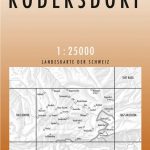 Rodersdorf Swisstopo 1066
 Sissach Swisstopo 1068
 Hauenstein Swisstopo 1088
 Bellelay Swisstopo 1105
 Balsthal Swisstopo 1107
Hitzkirch Swisstopo 1110
Linthebene Swisstopo 1133
Balsthal Swisstopo 1107
Hitzkirch Swisstopo 1110
Linthebene Swisstopo 1133
 Le Locle Swisstopo 1143
 Wolhusen Swisstopo 1149
Alpnach Swisstopo 1170
Wolhusen Swisstopo 1149
Alpnach Swisstopo 1170
 Engelberg Swisstopo 1191
 Silvretta Swisstopo 1198
Scuol Swisstopo 1199
Silvretta Swisstopo 1198
Scuol Swisstopo 1199
 Guttannen Swisstopo 1230
Col de la Faucille Swisstopo 1260
Guttannen Swisstopo 1230
Col de la Faucille Swisstopo 1260
 Campodolcino Swisstopo 1275
 Sciora Swisstopo 1296
 Sion Swisstopo 1306
 St. Niklaus Swisstopo 1308
 Barberine Swisstopo 1324
Tesserete Swisstopo 1333
Barberine Swisstopo 1324
Tesserete Swisstopo 1333
 Chanrion Swisstopo 1346