Disclosure : This site contains affiliate links to products. We may receive a commission for purchases made through these links.
Thorsmork – Landmannalaugar IDNU Map
รรณrsmรถrk – Landmannalaugar region at 1:100,000 in a series of special detailed hiking and touring maps based on the Icelandic topographic survey, covering an area east and south of the Hekla volcano, showing the lava fields annotated with dates of various eruptions. Contours are at 20-metre intervals, with several types of terrain and vegetation indicated, e.g. different types of forest, sand, moraine, lava, etc. Nearby roads and tracks indicate fords across the rivers. Footpaths and shelters are marked. The map has a grid with latitude and longitude in steps of 10` and 30` respectively. Map legend includes English.To see the list of titles in this series please click on the series link.

Related Products:
 Landmannalaugar – รorsmork – Fjallabak – Eyjafjallajokull Volcano
 Husavik – Lake Mรฝvatn IDNU Map
 Iceland Highlands IDNU 5
 Iceland North-East IDNU 3
Iceland North-West IDNU 1
Iceland South-West IDNU 2
Iceland South-East IDNU 4
Hornstrandir IDNU Map
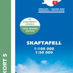
Skaftafell National Park IDNU Map
Iceland North-East IDNU 3
Iceland North-West IDNU 1
Iceland South-West IDNU 2
Iceland South-East IDNU 4
Hornstrandir IDNU Map
Skaftafell National Park IDNU Map
 Gullfoss – Geysir – Hekla
 Hornstrandir
 Skaftafell
 Snรฆfellsnes
 Reykjanes – รingvellir
 Lรณnsรถrรฆfi – Snรฆfell
 Kjรถlur – Langjรถkull – Kerlingrafjรถll
 Akureyri – Mรฝvatn – Dettifoss
Askja – Herdubreid – Kverkfjรถll
Akureyri – Mรฝvatn – Dettifoss
Askja – Herdubreid – Kverkfjรถll
 Western Fjords
 Mรฝrar
 รrnes
รrnes
 Snรฆfell
 Reykjanesskagi
 Dalir
Dalir
 Strandir
 Skagi
Skagi
 Vatnsdalur
 Kelduhverfi
 Langanes
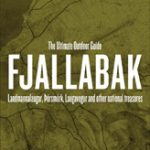 Fjallabak
 Barรฐastrรถnd
 Arnarfjรถrรฐur
 Langjรถkull
 Nรฝjabรฆjarfjall
 Eyjafjรถrรฐur
 ร–xarfjรถrรฐur
 ร–rรฆfajรถkull
 Hornafjรถrรฐur
 Seyรฐisfjรถrรฐur
 Reyรฐarfjรถrรฐur