Disclosure : This site contains affiliate links to products. We may receive a commission for purchases made through these links.
The World – The National Geographic 125th Anniversary Wall Map PAPER
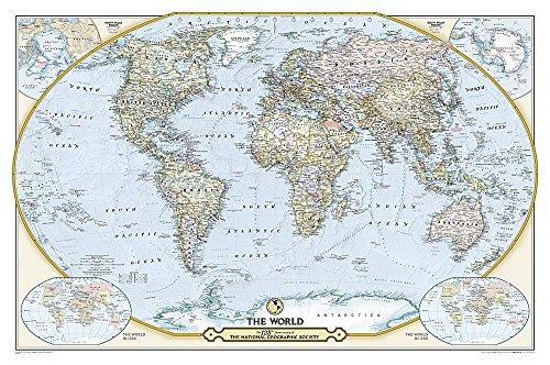
National Geographic’s 125th Anniversary World Wall Map, paper version – size 117 x 77.5cm (46″ x 30.5″ approx). A contemporary political world map with two insets showing the world in 1888 and 1988.This is a present day political map of the world showing countries in pleasant pastel colours. All place names are in their English versions. On land the map has very subtle relief shading with names of main geographic features: deserts, mountain ranges, highest peaks (altitude in feet), etc. On light blue oceans stronger shading shows the sea floor with names of ridges, basins, plateaux, etc. North and South Polar regions are presented on insets. The map has latitude and longitude lines at 30ยฐ, plus clocks indicating time difference from GMT. Two more insets show the world in 1888 and 1988 ‘“ the Society’s founding and centennial years.Please note: this title is also available as an encapsulated wall map, or on paper in a folded version.

Related Products:
 The World – The National Geographic 125th Anniversary Wall Map ENCAPSULATED
 World: National Geographic Society Decorator Style Political Wall Maps
 World: National Geographic Society Executive Style Political Wall Maps
 World NGS Decorator Wall Map PAPER
 World NGS Decorator Wall Map LARGE PAPER
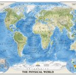 World NGS Physical Wall Map POSTER-SIZE PAPER
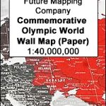 Future Map Company Commemorative Olympic World Wall Map PAPER
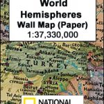 World Hemispheres NGS Wall Map PAPER
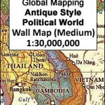 World Global Mapping Antique Political Wall Map LARGE PAPER
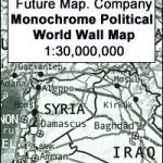 Future Mapping Company Monochrome Political World Wall Map PAPER
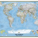
 World: National Geographic Society Classic Style Political Wall Maps
 World NGS Physical / Ocean Floor Wall Map LARGE PAPER
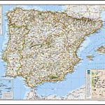 Spain and Portugal NGS Classic Wall Map PAPER
 World NGS Explorer Executive Wall Map PAPER
 World F&B Political Wall Map LARGE
 World NGS Physical / Ocean Floor Wall Map ENCAPSULATED
 Stanford`s Pacific-centred World Map (1884) – A3 Wall Map, Paper
Stanford`s Pacific-centred World Map (1884) – A2 Wall Map, Paper
Stanford`s Pacific-centred World Map (1884) – A1 Wall Map, Paper
Stanford`s Pacific-centred World Map (1884) – A3 Wall Map, Paper
Stanford`s Pacific-centred World Map (1884) – A2 Wall Map, Paper
Stanford`s Pacific-centred World Map (1884) – A1 Wall Map, Paper
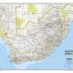 South Africa NGS Classic Wall Map PAPER
 World NGS Executive Wall Map POSTER-SIZE PAPER
 United States NGS National Parks Wall Map PAPER
 World Geological Wall Map LARGE, PAPER
 World Michelin Wall Map PAPER
 Stanford`s Library Map of the World (1879) – A3 Wall Map, Paper
 World NGS Classic Wall Map PAPER
 World NGS Classic Wall Map POSTER-SIZE PAPER
 National Geographic World Executive Spanish – Published 2005 988 x 646 mm
 World Collins Wall Map PAPER
 World NGS Executive Wall Map LARGE PAPER
 World NGS Classic Wall Map LARGE PAPER
 World NGS Physical / Ocean Floor Wall Map LARGE ENCAPSULATED
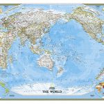
 World NGS Executive Pacific-Centered Wall Map PAPER
 World NGS Executive Wall Map PAPER
 Stanford`s Library Map of the World (1879) – Original Size Wall Map, Paper
Stanford`s Library Map of the World (1879) – A2 Wall Map, Paper – Print on Demand
Stanford`s Library Map of the World (1879) – A1 Wall Map, Paper – Print on Demand
Stanford`s Library Map of the World (1879) – Original Size Wall Map, Paper
Stanford`s Library Map of the World (1879) – A2 Wall Map, Paper – Print on Demand
Stanford`s Library Map of the World (1879) – A1 Wall Map, Paper – Print on Demand
 World Global Mapping Political Wall Map LARGE PAPER
 World NGS Decorator Wall Map ENCAPSULATED
 World NGS Classic Pacific-Centered Wall Map LARGE PAPER