Disclosure : This site contains affiliate links to products. We may receive a commission for purchases made through these links.
Disclosure : This site contains affiliate links to products. We may receive a commission for purchases made through these links.
Categories
-
Best Sellers
-

Whitechapel, Spitalfields & The Bank 1894 – 63.2
Whitechapel, Spitalfields and The Bank in 1894 in a fascinating series of reproductions of old Ordnance Survey plans in the Alan Godfrey Editions, ideal for anyone Read More » -
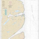
NOAA Chart 17333 – Chatham Strait’”Ports Herbert, Walter, Lucy and Armstrong
NOAA maintains the nautical charts and publications for U.S. coasts and the Great Lakes. Over a thousand charts cover 95,000 miles of shoreline and 3.4 million Read More » -

Dull Men`s Club Calendar 2022. Quirky Passions
This calendar is about people and events Celebrating the Ordinary (our motto). They find things they care deeply about that others frequently overlook. They tell us Read More » -

Leave Me Alone with the Recipes: The Life, Art, and Cookbook of Cipe Pineles
The newly discovered illustrated recipes of wildly influential yet unsung designer Cipe Pineles, introducing her delectable work in food and art to a new generation.Not long Read More » -

Arad Topo 15/16 HEBREW
One of the titles in a series of maps from the Israeli Survey, in Hebrew – with some Roman alphabet equivalents, providing coverage of the whole Read More » -
Elven – Grand-Champ IGN 0920SB
Topographic survey of France at 1:25,000 in IGN`s excellent TOP25 / Sรฉrie Bleue series. All the maps are GPS compatible, with a 1km UTM grid plus Read More » -

James Sherwood`s Discriminating Guide to London: An Unabashed Companion to the Very Finest Experiences in the World`s Most Cosmopolitan City
James Sherwood`s Discriminating Guide to London is a very 21st-century comment on city style. Sherwood, author of a number of definitive publications on English sartorial style, Read More » -
Huntingdon (M)
-

Fraserburgh, Peterhead & Ellon OS Landranger Map 30 (paper)
Paper version of map No. 30 from the Ordnance Survey’s Landranger series at 1:50,000, with contoured and GPS compatible topographic mapping plus tourist information.MOBILE DOWNLOADS: As Read More » -
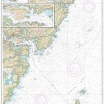
NOAA Chart 13283 – Portsmouth Harbor’”Cape Neddick Harbor to Isles of Shoals – Portsmouth Harbor
NOAA maintains the nautical charts and publications for U.S. coasts and the Great Lakes. Over a thousand charts cover 95,000 miles of shoreline and 3.4 million Read More »
-


