Disclosure : This site contains affiliate links to products. We may receive a commission for purchases made through these links.
The Thames Path Cicerone Map Booklet
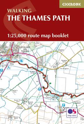
The Thames Path from the the river`s source to Erith in south-east London on mapping at 1:25,000 from the Ordnance Survey’s Explorer series in a pocket-size booklet from Cicerone Press. The 288km / 180-mile trail is presented with a route profile, plus summaries for each section showing GPS coordinates for the start and finish, distance and approximate walking time in either direction.Mapping in the pocket booklets from Cicerone Press is identical to the OS Explorer Series, but with the route more prominently highlighted: contours at 5m or 10m intervals, extensive range of symbols for tourist information including campsites, pubs, castles and forts, museums, etc, and for GPS users the lines of the British National Grid at 1km intervals.To see other titles in this series please click on the series link.

Related Products:
 Pembrokeshire Coast Path Cicerone Map Booklet
 Offa`s Dyke Path Cicerone Map Booklet
 Hadrian`s Wall Path Cicerone Map Booklet
 Great Glen Way Cicerone Map Booklet
 Cotswold Way Cicerone Map Booklet
 Great Britain: Cicerone Press Long-distance Paths Map Booklets
 South West Coast Path 1 – Minehead to St Ives Cicerone Map Booklet
 South West Coast Path 2 – St Ives to Plymouth Cicerone Map Booklet
 South West Coast Path 3 – Plymouth to Poole Cicerone Map Booklet
 Two Moors Way Cicerone Map Booklet
 The Dales Way Cicerone Map Booklet
 Speyside Way Cicerone Map Booklet
 The Cleveland Way Cicerone Map Booklet
 The Ridgeway Cicerone Map Booklet
 North Downs Way Cicerone Map Booklet
 Pennine Way Cicerone Map Booklet
 River Thames and the Thames Path Heron Maps
 River Thames & Thames Path Heron Map
 Thames Path: Thames Head to the Thames Barrier (London)
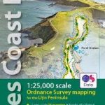 Llyn Peninsula Coastal Path – Wales Coast Path Map-Booklet
 Thames Path:National Trail from London to the river`s source in Gloucestershire
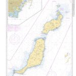
 Isle of Anglesey Coastal Path – Wales Coast Path Map-Booklet
 Thames Path A-Z National Trail Road Map
 West Highland Way Cicerone Map Booklet
 Cicerone European Walking & Trekking Guides (Non UK and Ireland)
 Cicerone World Walking & Trekking Guides (Non Europe, UK and Ireland)
 Cicerone Great Britain & Ireland Walking Guides
 The Coast to Coast Cicerone Map Booklet
 Chiltern Hills West – Henley-on-Thames & Wallingford OS Explorer Active Map 171 (waterproof)
 Chiltern Hills West – Henley-on-Thames & Wallingford OS Explorer Map 171 (paper)
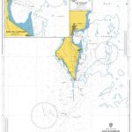
 North Wales Coast – Chester to Bangor – Wales Coast Path Map-Booklet
 Thames Path in London: Hampton Court to Crayford Ness
 The South Downs Way Map Booklet
 Dales Way Map Booklet
 Cicerone Great Britain & Ireland Cycling Guides
 Thames Path in the Country: From the Source to Hampton Court
 Thames Path 3
 Thames Estuary, Rochester & Southend-on-Sea OS Landranger Map 178 (paper)
 Reading & Windsor – Henley-on-Thames & Bracknell OS Landranger Map 175 (paper)