Disclosure : This site contains affiliate links to products. We may receive a commission for purchases made through these links.
The Peak District Sustrans Cycle Map 26 – Trans Pennine Trail – Tissington Trail – High Peak Trail
This area map shows the National Cycle Network and local routes in this area. It covers The Peak District National Park region in England, including Sheffield, Chesterfield, Buxton, Rotherham, Worksop and Macclesfield.This pocket-sized colour map shows clearly mapped on-road and traffic-free paths, easy to read contours, and detailed inset maps for the major towns and cities as well as recommended linking routes connecting the NCN with quiet roads. The map also features 5 day rides with directions and a description of the area, highlighting key cycle routes and places of interest.

Related Products:
 South Cumbria & The Lake District Sustrans Cycle Map 31
 Cornwall Sustrans Cycle Map 1 – The Camel Trail – Clay Trails – Mineral Tramways
 Merseyside & Manchester – Pennine Cycleway – The Trans Pennine Trail Sustrans Cycle Map 25
North York Moors, Tees Valley & Durham Coast Sustrans Cycle Map 33
Merseyside & Manchester – Pennine Cycleway – The Trans Pennine Trail Sustrans Cycle Map 25
North York Moors, Tees Valley & Durham Coast Sustrans Cycle Map 33
 Lancashire Sustrans Cycle Map 30
 Mid-Wales North Sustrans Cycle Map 23
 Central Sussex & South Surrey Sustrans Cycle Map 7
 Oban to Inverness Cycle Route Map
 Lochs & Glens North Cycle Route
 South East Wales – Taff Trail – Celtic Trail – Lon Las Cymru – 3 Parks Trail Sustrans Cycle Map 12
 Devon North Sustrans Cycle Map 3 – Including the Tarka Trail
 Bath to Bournemouth Sustrans Cycle Route Map
 Land`s End to John O`Groats – On the National Cycle Network: Official Sustrans Guide
 Celtic Trail Sustrans Cycle Route Map
 South Pennines and Peak District Off-road Cycle Map
 EuroVelo 6 – Danube Bike Trail – Basel to Budapest Cycle Trail 7-Map Set
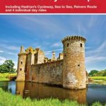
 Hadrian`s Cycleway Sustrans Cycle Route Map
London Sustrans Cycle Map 53
Hadrian`s Cycleway Sustrans Cycle Route Map
London Sustrans Cycle Map 53
 Aberdeenshire 110K Sustrans Cycle Map No. 45
Hampshire & Isle of Wight Sustrans Cycle Map 6
Aberdeenshire 110K Sustrans Cycle Map No. 45
Hampshire & Isle of Wight Sustrans Cycle Map 6
 Devon South Sustrans Cycle Map 2
 Lincolnshire and Wolds Sustrans Cycle Map 27
 Oban, Kintyre & the Trossachs 110K Sustrans Cycle Map No. 42
 Great Glen & Loch Ness 110K Sustrans Cycle Map No. 47
 Kent 110K Sustrans Cycle Map No. 8
 Pennine Cycleway North Sustrans Cycle Route Map
 Cairngorms & Moray Coast 110K Sustrans Cycle Map No. 46
 Lanarkshire & Scottish Borders 110K Sustrans Cycle Map No. 38
 West Dumfries & Galloway 110K Sustrans Cycle Map No. 36
 South West Wales 110K Sustrans Cycle Map No. 13
County Durham & North Yorkshire Sustrans Cycle Map 32
South West Wales 110K Sustrans Cycle Map No. 13
County Durham & North Yorkshire Sustrans Cycle Map 32
 East Midlands 110K Sustrans Cycle Map No. 21
 Shropshire, Staffordshire & The Black Country 110K Sustrans Cycle Map No. 22
 Warwickshire & South Midlands 110K Sustrans Cycle Map No. 16
 North Cumbria & Dumfries 110K Sustrans Cycle Map No. 35
 Dundee, Angus & North Fife 110K Sustrans Cycle Map No. 44
Yorkshire Wolds, York & the Humber Sustrans Cycle Map 28
Dundee, Angus & North Fife 110K Sustrans Cycle Map No. 44
Yorkshire Wolds, York & the Humber Sustrans Cycle Map 28
 The Varsity Way Sustrans Cycle Route Map
 Perth, Callander & Pitlochry 110K Sustrans Cycle Map No. 43