Disclosure : This site contains affiliate links to products. We may receive a commission for purchases made through these links.
The Near East: Industries & Communication c.1900

Related Products:
 The Far East: Industries & Communications c.1900
 East Indies & Indo-China: Industries & Communications c.1900
Africa: Industries & Communications c.1900
East Indies & Indo-China: Industries & Communications c.1900
Africa: Industries & Communications c.1900
 Austria-Hungary: Industries & Communications c.1900
 South Africa: Industries & Communications c.1900
 British Isles: Industries & Communications c.1900
South America: Industries & Communications c.1900
North America: Industries & Communications c.1900
West Indies & Central America: Industries & Communications c.1900
British Isles: Industries & Communications c.1900
South America: Industries & Communications c.1900
North America: Industries & Communications c.1900
West Indies & Central America: Industries & Communications c.1900
 Swadlincote (East) & Woodville 1900 – 60.07
North-East United States c.1900
The Home Counties & the East of England c.1900
Dublin & South-east Ireland with Town Plans of London & Edinburgh c.1900
Swadlincote (East) & Woodville 1900 – 60.07
North-East United States c.1900
The Home Counties & the East of England c.1900
Dublin & South-east Ireland with Town Plans of London & Edinburgh c.1900
 City of Salisbury with West Harnham & East Harnham 1900 – 66.15
 British Isles Communication OS Wall Map LAMINATED
 SMCP – Standard Marine Communication Phrases with CD
 IMO SMPC – Standard Marine Communication Phrases – E-Reader
 Greenwich at Work: People and Industries Through the Years
 Never Lost Again: The Google Mapping Revolution That Sparked New Industries and Augmented Our Reality
East Frisia – East Frisian Islands Marco Polo Leisure Map 05
Never Lost Again: The Google Mapping Revolution That Sparked New Industries and Augmented Our Reality
East Frisia – East Frisian Islands Marco Polo Leisure Map 05
 Maryport 1900 – 44.08
Chatteris 1900 – 20.16
Maryport 1900 – 44.08
Chatteris 1900 – 20.16
 Bedford 1900 – 11.16a
Scottish Lowlands c.1900
British Isles Physical c.1900
Persia & the Afghan Boundary c.1900
A History Of The English-Speaking Peoples Since 1900
Bedford 1900 – 11.16a
Scottish Lowlands c.1900
British Isles Physical c.1900
Persia & the Afghan Boundary c.1900
A History Of The English-Speaking Peoples Since 1900
 The Iconic House: Architectural Masterworks Since 1900
 Burton (North) 1900: Staffordshire Sheet 40.12
 Swadlincote (West) & Church Gresley 1900 – 60.06
Cape Colony & the Diamond Fields c.1900
Indian Empire & the Afghan Boundary c.1900
Modern Palestine & the Sinai Peninsula c.1900
Bengal Provinces, Burma, and Southern Tibet c.1900
Swadlincote (West) & Church Gresley 1900 – 60.06
Cape Colony & the Diamond Fields c.1900
Indian Empire & the Afghan Boundary c.1900
Modern Palestine & the Sinai Peninsula c.1900
Bengal Provinces, Burma, and Southern Tibet c.1900
 Crafted in Britain: The Survival of Britain`s Traditional Industries
East Midlands and East Anglia including London Administrative Boundary Wall Map
Crafted in Britain: The Survival of Britain`s Traditional Industries
East Midlands and East Anglia including London Administrative Boundary Wall Map
 South East England – Midlands – East Anglia Michelin Regional 504
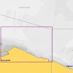
 NP43 South and East Coasts of Korea, East Coast of Siberia and Sea of Okhotsk Pilot
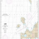
 NP43 South and East Coasts of Korea, East Coast of Siberia and Sea of Okhotsk Pilot – Digital
Shaftesbury 1900
NP43 South and East Coasts of Korea, East Coast of Siberia and Sea of Okhotsk Pilot – Digital
Shaftesbury 1900