Disclosure : This site contains affiliate links to products. We may receive a commission for purchases made through these links.
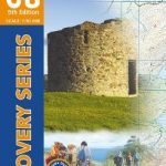
The National Forest – Burton upon Trent – Swadlincote OS Explorer 245
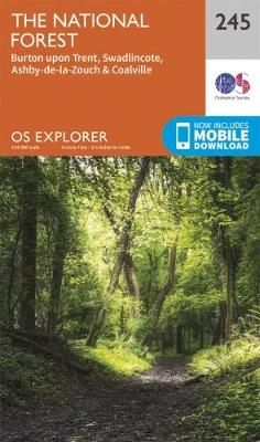
Providing complete GB coverage the series details essential information such as youth hostels, pubs and visitor information as well as rights of way, permissive paths and bridleways
Related Products:
 Wye Valley & Forest of Dean OS Explorer OL14
 Snowdon / Yr Wyddfa – Conwy Valley / Dyffryn Conwy OS Explorer OL17
 New Forest – Southampton – Ringwood – Ferndown – Lymington – Christchurch & Bournemouth OS Explorer OL22
 Cadair Idris & Llyn Tegid OS Explorer OL23
 Harlech, Porthmadog & Bala / Y Bala OS Explorer OL18
 The Peak District – Dark Peak Area OS Explorer OL1
 Isle of Arran OS Explorer 361
 Dartmoor OS Explorer OL28
 North Pembrokeshire / Gogledd Sir Benfro OS Explorer OL35
 Howgill Fells & Upper Eden Valley OL Explorer OL19
 Yorkshire Dales – Northern & Central Areas – Wensleydale & Swaledale OS Explorer OL30
 Brighton & Hove – Lewes & Burgess Hill OS Explorer OL11
 Holy Island & Bamburgh – Wooler – Belford & Seahouses OS Explorer 340
 The English Lakes – North-Western Area – Keswick, Cockermouth & Wigton OS Explorer OL4
 The English Lakes – North-Eastern Area – Penrith, Patterdale & Caldbeck OS Explorer OL5
 The English Lakes – South-Eastern Area – Windermere, Kendal & Silverdale OS Explorer OL7
 Isle of Wight OS Explorer OL29
 The English Lakes – South-Western Area – Coniston, Ulverston & Barrow-in-Furness OS Explorer OL6
 Burton upon Trent – Ashby-de-la-Zouch – Coalville – Swadlincote A-Z Street Atlas
 The Peak District – White Peak Area – Buxton – Bakewell – Matlock & Dove Dale OS Expolorer OL24
 Derby & Burton upon Trent OS Landranger Map 128 (paper)
 Derby & Burton upon Trent OS Landranger Active Map 128 (waterproof)
 Newark-on-Trent – Retford, Southwell & Saxilby OS Explorer Map 271 (paper)
 Newark-on-Trent – Retford, Southwell & Saxilby OS Explorer Active Map 271 (waterproof)
 Stoke-on-Trent & Newcastle-under-Lyme – Biddulph & Stone OS Explorer Map 258 (paper)
 Stoke-on-Trent & Newcastle-under-Lyme – Biddulph & Stone OS Explorer Active Map 258 (waterproof)
 Burton on Trent South 1900
 Glen Shiel & Kintail Forest – Shiel Bridge, Morvich, Killilan & Kinloch Hourn Forest OS Explorer Active Map 414 (waterproof)
 Llandeilo & Brechfa Forest – Llanybydder OS Explorer Map 186 (paper)
 Wyre Forest & Kidderminster – Bridgnorth OS Explorer Map 218 (paper)
 Liddesdale & Kershope Forest – Newcastleton & Canonbie OS Explorer 324
 Bridport & West Bay Walking Map 46 – Golden Cap to Burton Bradstock
 Sherwood Forest – Mansfield, Worksop & Edwinstowe OS Explorer Map 270 (paper)
 Wyre Forest & Kidderminster – Bridgnorth OS Explorer Active Map 218 (waterproof)
 Marlborough & Savernake Forest – Avebury & Devizes OS Explorer Map 157 (paper)
 Epping Forest & Lee Valley – Hertford & Harlow OS Explorer Map 174 (paper)
 Corby, Kettering & Wellingborough – Rockingham Forest OS Explorer Map 224 (paper)
 Llandeilo & Brechfa Forest – Llanybydder OS Explorer Active Map 186 (waterproof)
 Northwich & Delamere Forest – Winsford & Middlewich OS Explorer Map 267 (paper)
 Dumfries & Dalbeattie – New Abbey & Mabie Forest OS Explorer Map 313 (paper)


